Ghiffa geodata
Ghiffa (Piedmont) is a seat of a third-order administrative division; located in Italy in Europe/Rome (GMT+2) time zone. With population of 2,241 people, there are 3822 cities with bigger population in this country. Compared to other cities in Italy, 90.7% of cities are located further ↓South; 86.7% of cities are located further →East and 64.1% of cities have lower elevation than Ghiffa. Note1
Administrative division(s):
- Level 1: Piedmont
- Level 2: Provincia Verbano-Cusio-Ossola
- Level 3: Ghiffa


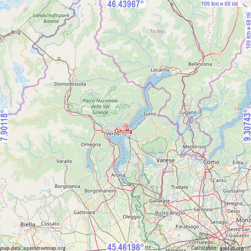
Ghiffa GPS coordinates[2]
45° 57' 10.728" North, 8° 36' 15.48" East
| Map corner | latitude | longitude |
|---|---|---|
| Upper-left | 46.43967°, | 7.90118° |
| Center: | 45.95298°, | 8.6043° |
| Lower-right: | 45.46198°, | 9.30743° |
| Map W x H: | 108.7×108.7 km | = 67.5×67.5mi |
| max Lat: | 47.04031° ⇑9.3% North |
| Ghiffa: | 45.95298° |
| min Lat: | ⇓90.7% South 35.50142° |
| min Long | Ghiffa | max Long |
| 6.69888° | 8.6043° | 18.48682° |
| W 13.3%⇐ | ⇒86.7% E |
Elevation
Elevation of Ghiffa is 335 m = 1099 ft, and this is 28.3 m = 93 ft above average elevation for this country.
| Max E: |
2085 m = 6841 ft | 35.9% |
| Ghiffa | 335 m 1099 ft | |
| Avg. | 306.7 m = 1006 ft | |
Min E: |
-4 m = -13 ft | 64.1% |
See also: Italy elevation on elevation.city.
Geographical zone
Ghiffa is located in North temperate zone (between Tropic of Cancer and the Arctic Circle). Distance of this North polar circle is 2291.7 km =1424 mi to North.| Distance of | km | miles | from Ghiffa |
|---|---|---|---|
| North Pole | 4897.6 | 3043.2 | to North |
| Arctic Circle | 2291.7 | 1424 | to North |
| Tropic Cancer | 2503.6 | 1555.7 | to South |
| Equator | 5109.5 | 3174.9 | to South |


Nearby cities:
15 places around Ghiffa: (largest is in red/bold)
• Arizzano
1.7 km =1.1 mi,  286°
286°
• Aurano
5.4 km =3.4 mi,  346°
346°
• Bee
2.5 km =1.6 mi,  297°
297°
• Cambiasca
4.7 km =2.9 mi,  282°
282°
• Caprezzo
4.5 km =2.8 mi,  315°
315°
• Castello
5.5 km =3.4 mi,  93°
93°
• Castelveccana
4.8 km =3 mi,  96°
96°
• Gonte
5.9 km =3.7 mi,  36°
36°
• Intragna
5.2 km =3.2 mi,  333°
333°
• Laveno
5.1 km =3.2 mi,  165°
165°
• Oggebbio
5.3 km =3.3 mi, 37°
• Pallanza-Intra-Suna
3.1 km =1.9 mi,  236°
236°
• Premeno
2.9 km =1.8 mi, 346°
• Verbania
5.4 km =3.4 mi,  229°
229°
• Vignone
3.3 km =2.1 mi, 286°
Sources, notices
• [Note1] Compared only with cities in Italy existing in our database
• [Src1] Map data: © OpenStreetMap contributors (CC-BY-SA)
• [Src2] Other city data from geonames.org with taken over terms of usage.
• [Src3] Geographical zone / Annual Mean Temperature by Robert A. Rohde @ Wikipedia
