Grassina Ponte a Ema geodata
Grassina Ponte a Ema (Tuscany) is a populated place; located in Italy in Europe/Rome (GMT+2) time zone. With population of 8,412 people, there are 1143 cities with bigger population in this country. Compared to other cities in Italy, 57.7% of cities are located further ↑North; 53.1% of cities are located further →East and 72.2% of cities have higher elevation than Grassina Ponte a Ema. Note1
Current local time in Grassina Ponte a Ema:
07:56 PM, WednesdayDifference from your time zone: hours


Grassina Ponte a Ema GPS coordinates[2]
43° 43' 59.988" North, 11° 18' 0" East
| Map corner | latitude | longitude |
|---|---|---|
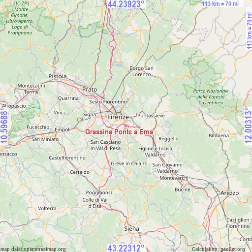
| Upper-left | 44.23923°, | 10.59688° |
| Center: | 43.73333°, | 11.3° |
| Lower-right: | 43.22312°, | 12.00313° |
| Map W x H: | 113×113 km | = 70.2×70.2mi |
| max Lat: | 47.04031° ⇑57.7% North |
| Grassina Ponte a Ema: | 43.73333° |
| min Lat: | ⇓42.3% South 35.50142° |
| min Long | Grassina Ponte | max Long |
| 6.69888° | 11.3° | 18.48682° |
| W 46.9%⇐ | ⇒53.1% E |
Elevation
Elevation of Grassina Ponte a Ema is 87 m = 285 ft, and this is 219.7 m = 721 ft below average elevation for this country.
| Max E: |
2085 m = 6841 ft | 72.2% |
| Avg. | 306.7 m = 1006 ft | |
| Grassina Ponte a Ema | 87 m = 285 ft | |
Min E: |
-4 m = -13 ft | 27.8% |
See also: Italy elevation on elevation.city.
Geographical zone
Grassina Ponte a Ema is located in North temperate zone (between Tropic of Cancer and the Arctic Circle). Distance of this Northern Tropic circle is 2256.8 km =1402.3 mi to South.| Distance of | km | miles | from Grassina Ponte a Ema |
|---|---|---|---|
| North Pole | 5144.4 | 3196.6 | to North |
| Arctic Circle | 2538.5 | 1577.4 | to North |
| Tropic Cancer | 2256.8 | 1402.3 | to South |
| Equator | 4862.7 | 3021.5 | to South |


Nearby cities:
15 places around Grassina Ponte a Ema: (largest is in red/bold)
• Antella
1.9 km =1.2 mi,  109°
109°
• Bagno a Ripoli
2.7 km =1.7 mi,  42°
42°
• Balatro
2.1 km =1.3 mi,  135°
135°
• Compiobbi
7.4 km =4.6 mi, 39°
• Fiesole
7.9 km =4.9 mi,  357°
357°
• Florence
6.7 km =4.2 mi,  319°
319°
• Impruneta
6.6 km =4.1 mi,  214°
214°
• Osteria Nuova
3.6 km =2.2 mi,  94°
94°
• Rimaggio
3.7 km =2.3 mi, 43°
• San Jacopo al Girone
5.2 km =3.2 mi, 38°
• San Polo in Chianti
8.3 km =5.2 mi, 144°
• Scandicci
9.3 km =5.8 mi,  284°
284°
• Strada in Chianti
8.3 km =5.2 mi,  181°
181°
• Tavarnuzze
7.1 km =4.4 mi,  248°
248°
• Troghi
8 km =5 mi, 105°
Sources, notices
• [Note1] Compared only with cities in Italy existing in our database
• [Src1] Map data: © OpenStreetMap contributors (CC-BY-SA)
• [Src2] Other city data from geonames.org with taken over terms of usage.
• [Src3] Geographical zone / Annual Mean Temperature by Robert A. Rohde @ Wikipedia
