Tavarnuzze geodata
Tavarnuzze (Tuscany) is a populated place; located in Italy in Europe/Rome (GMT+2) time zone. With population of 4,228 people, there are 2269 cities with bigger population in this country. Compared to other cities in Italy, 58% of cities are located further ↑North; 54.2% of cities are located further →East and 74.7% of cities have higher elevation than Tavarnuzze. Note1


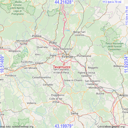
Tavarnuzze GPS coordinates[2]
43° 42' 36.684" North, 11° 13' 1.956" East
| Map corner | latitude | longitude |
|---|---|---|
| Upper-left | 44.21628°, | 10.51409° |
| Center: | 43.71019°, | 11.21721° |
| Lower-right: | 43.19979°, | 11.92034° |
| Map W x H: | 113×113 km | = 70.2×70.2mi |
| max Lat: | 47.04031° ⇑58% North |
| Tavarnuzze: | 43.71019° |
| min Lat: | ⇓42% South 35.50142° |
| min Long | Tavarnuzze | max Long |
| 6.69888° | 11.21721° | 18.48682° |
| W 45.8%⇐ | ⇒54.2% E |
Elevation
Elevation of Tavarnuzze is 75 m = 246 ft, and this is 231.7 m = 760 ft below average elevation for this country.
| Max E: |
2085 m = 6841 ft | 74.7% |
| Avg. | 306.7 m = 1006 ft | |
| Tavarnuzze | 75 m = 246 ft | |
Min E: |
-4 m = -13 ft | 25.3% |
See also: Italy elevation on elevation.city.
Geographical zone
Tavarnuzze is located in North temperate zone (between Tropic of Cancer and the Arctic Circle). Distance of this Northern Tropic circle is 2254.2 km =1400.7 mi to South.| Distance of | km | miles | from Tavarnuzze |
|---|---|---|---|
| North Pole | 5146.9 | 3198.1 | to North |
| Arctic Circle | 2541.1 | 1579 | to North |
| Tropic Cancer | 2254.2 | 1400.7 | to South |
| Equator | 4860.1 | 3019.9 | to South |


Nearby cities:
15 places around Tavarnuzze: (largest is in red/bold)
• Antella
8.7 km =5.4 mi,  76°
76°
• Bagno a Ripoli
9.6 km =6 mi,  61°
61°
• Balatro
8.2 km =5.1 mi, 82°
• Cerbaia
7.6 km =4.7 mi,  248°
248°
• Chiesanuova
2.6 km =1.6 mi,  255°
255°
• Florence
8 km =5 mi,  16°
16°
• Grassina Ponte a Ema
7.1 km =4.4 mi,  68°
68°
• Impruneta
4.1 km =2.5 mi,  133°
133°
• Mantignano-Ugnano
8.9 km =5.5 mi,  334°
334°
• Mercatale
8.2 km =5.1 mi,  173°
173°
• Romola
4.5 km =2.8 mi, 255°
• San Casciano in Val di Pesa
6.2 km =3.9 mi,  204°
204°
• San Martino alla Palma
7.3 km =4.5 mi,  306°
306°
• Scandicci
5.4 km =3.4 mi, 334°
• Strada in Chianti
8.6 km =5.3 mi, 131°
Sources, notices
• [Note1] Compared only with cities in Italy existing in our database
• [Src1] Map data: © OpenStreetMap contributors (CC-BY-SA)
• [Src2] Other city data from geonames.org with taken over terms of usage.
• [Src3] Geographical zone / Annual Mean Temperature by Robert A. Rohde @ Wikipedia
