Poggio Picenze geodata
Poggio Picenze (Abruzzo) is a seat of a third-order administrative division; located in Italy in Europe/Rome (GMT+2) time zone. With population of 1,036 people, there are 6522 cities with bigger population in this country. Compared to other cities in Italy, 67.6% of cities are located further ↑North; 74.1% of cities are located further ←West and 90.7% of cities have lower elevation than Poggio Picenze. Note1
Administrative division(s):
- Level 1: Abruzzo
- Level 2: Provincia dell' Aquila
- Level 3: Poggio Picenze


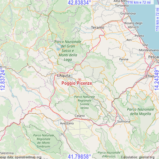
Poggio Picenze GPS coordinates[2]
42° 19' 14.196" North, 13° 32' 25.296" East
| Map corner | latitude | longitude |
|---|---|---|
| Upper-left | 42.83834°, | 12.83724° |
| Center: | 42.32061°, | 13.54036° |
| Lower-right: | 41.79858°, | 14.24349° |
| Map W x H: | 115.6×115.6 km | = 71.8×71.8mi |
| max Lat: | 47.04031° ⇑67.6% North |
| Poggio Picenze: | 42.32061° |
| min Lat: | ⇓32.4% South 35.50142° |
| min Long | Poggio Picenze | max Long |
| 6.69888° | 13.54036° | 18.48682° |
| W 74.1%⇐ | ⇒25.9% E |
Elevation
Elevation of Poggio Picenze is 737 m = 2418 ft, and this is 430.3 m = 1412 ft above average elevation for this country.
| Max E: |
2085 m = 6841 ft | 9.3% |
| Poggio Picenze | 737 m 2418 ft | |
| Avg. | 306.7 m = 1006 ft | |
Min E: |
-4 m = -13 ft | 90.7% |
See also: Italy elevation on elevation.city.
Geographical zone
Poggio Picenze is located in North temperate zone (between Tropic of Cancer and the Arctic Circle). Distance of this Northern Tropic circle is 2099.7 km =1304.7 mi to South.| Distance of | km | miles | from Poggio Picenze |
|---|---|---|---|
| North Pole | 5301.5 | 3294.2 | to North |
| Arctic Circle | 2695.6 | 1675 | to North |
| Tropic Cancer | 2099.7 | 1304.7 | to South |
| Equator | 4705.6 | 2923.9 | to South |


Nearby cities:
15 places around Poggio Picenze: (largest is in red/bold)
• Barisciano
4.1 km =2.5 mi,  83°
83°
• Camarda
9 km =5.6 mi,  337°
337°
• Cominio
8.9 km =5.5 mi,  264°
264°
• Fossa
5.3 km =3.3 mi,  234°
234°
• Monticchio
6.3 km =3.9 mi,  269°
269°
• Nucleo Industriale di Bazzano
6.2 km =3.9 mi,  286°
286°
• Paganica-Tempera
7 km =4.3 mi,  305°
305°
• Prata d'Ansidonia
7.3 km =4.5 mi,  130°
130°
• Progetto Case Bazzano
8.1 km =5 mi,  282°
282°
• San Demetrio Ne' Vestini
3.7 km =2.3 mi,  160°
160°
• San Panfilo d'Ocre
6.6 km =4.1 mi, 234°
• Sant'Eusanio Forconese
3.7 km =2.3 mi,  200°
200°
• Santo Stefano di Sessanio
8.9 km =5.5 mi,  73°
73°
• Vallecupa
8 km =5 mi, 159°
• Villa Sant'Angelo
5.6 km =3.5 mi,  182°
182°
Sources, notices
• [Note1] Compared only with cities in Italy existing in our database
• [Src1] Map data: © OpenStreetMap contributors (CC-BY-SA)
• [Src2] Other city data from geonames.org with taken over terms of usage.
• [Src3] Geographical zone / Annual Mean Temperature by Robert A. Rohde @ Wikipedia
