Vallecupa geodata
Vallecupa (Abruzzo) is a seat of a third-order administrative division; located in Italy in Europe/Rome (GMT+2) time zone. With population of 42 people, there are 11624 cities with bigger population in this country. Compared to other cities in Italy, 68.2% of cities are located further ↑North; 74.4% of cities are located further ←West and 88.2% of cities have lower elevation than Vallecupa. Note1


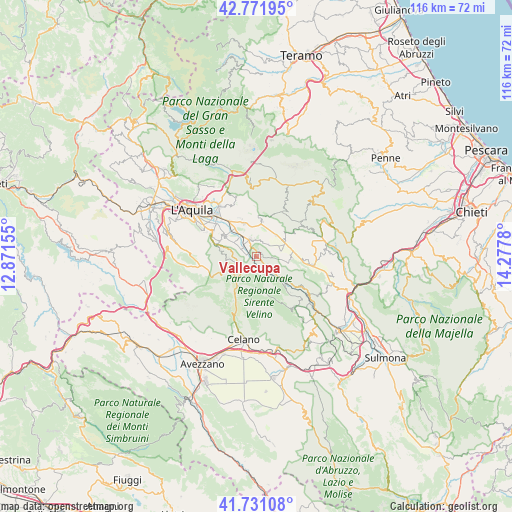
Vallecupa GPS coordinates[2]
42° 15' 13.176" North, 13° 34' 28.812" East
| Map corner | latitude | longitude |
|---|---|---|
| Upper-left | 42.77195°, | 12.87155° |
| Center: | 42.25366°, | 13.57467° |
| Lower-right: | 41.73108°, | 14.2778° |
| Map W x H: | 115.7×115.7 km | = 71.9×71.9mi |
| max Lat: | 47.04031° ⇑68.2% North |
| Vallecupa: | 42.25366° |
| min Lat: | ⇓31.8% South 35.50142° |
| min Long | Vallecupa | max Long |
| 6.69888° | 13.57467° | 18.48682° |
| W 74.4%⇐ | ⇒25.6% E |
Elevation
Elevation of Vallecupa is 676 m = 2218 ft, and this is 369.3 m = 1212 ft above average elevation for this country.
| Max E: |
2085 m = 6841 ft | 11.8% |
| Vallecupa | 676 m 2218 ft | |
| Avg. | 306.7 m = 1006 ft | |
Min E: |
-4 m = -13 ft | 88.2% |
See also: Italy elevation on elevation.city.
Geographical zone
Vallecupa is located in North temperate zone (between Tropic of Cancer and the Arctic Circle). Distance of this Northern Tropic circle is 2092.2 km =1300 mi to South.| Distance of | km | miles | from Vallecupa |
|---|---|---|---|
| North Pole | 5308.9 | 3298.8 | to North |
| Arctic Circle | 2703 | 1679.6 | to North |
| Tropic Cancer | 2092.2 | 1300 | to South |
| Equator | 4698.2 | 2919.3 | to South |


Nearby cities:
15 places around Vallecupa: (largest is in red/bold)
• Barisciano
8 km =5 mi,  9°
9°
• Caporciano
8.2 km =5.1 mi,  92°
92°
• Carapelle Calvisio
10.5 km =6.5 mi,  61°
61°
• Fontecchio
3.7 km =2.3 mi,  135°
135°
• Fossa
8.4 km =5.2 mi,  301°
301°
• Poggio Picenze
8 km =5 mi,  339°
339°
• Prata d'Ansidonia
3.9 km =2.4 mi,  45°
45°
• Rocca di Cambio
7.3 km =4.5 mi,  255°
255°
• Rocca di Mezzo
7.2 km =4.5 mi,  220°
220°
• San Demetrio Ne' Vestini
4.3 km =2.7 mi, 338°
• San Panfilo d'Ocre
8.9 km =5.5 mi,  293°
293°
• San Pio delle Camere
7.5 km =4.7 mi, 62°
• Sant'Eusanio Forconese
5.8 km =3.6 mi,  313°
313°
• Tione degli Abruzzi
7.5 km =4.7 mi, 137°
• Villa Sant'Angelo
3.6 km =2.2 mi, 301°
Sources, notices
• [Note1] Compared only with cities in Italy existing in our database
• [Src1] Map data: © OpenStreetMap contributors (CC-BY-SA)
• [Src2] Other city data from geonames.org with taken over terms of usage.
• [Src3] Geographical zone / Annual Mean Temperature by Robert A. Rohde @ Wikipedia
