Pesaro geodata
Pesaro (The Marches) is a seat of a second-order administrative division; located in Italy in Europe/Rome (GMT+2) time zone. With population of 77,241 people, there are 60 cities with bigger population in this country. Compared to other cities in Italy, 55.6% of cities are located further ↑North; 67.4% of cities are located further ←West and 94.8% of cities have higher elevation than Pesaro. Note1
Administrative division(s):
- Level 1: The Marches
- Level 2: Provincia di Pesaro e Urbino
- Level 3: Pesaro


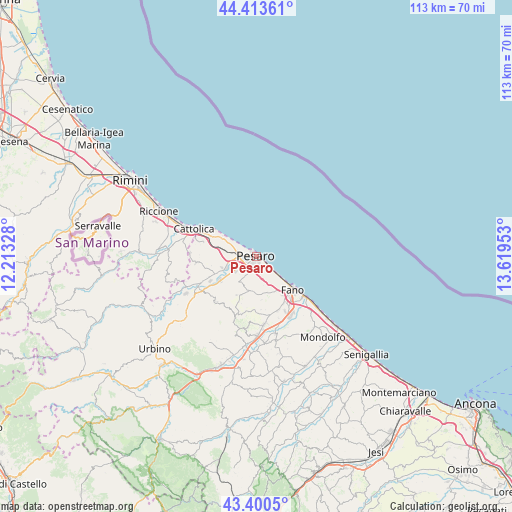
Pesaro GPS coordinates[2]
43° 54' 33.156" North, 12° 54' 59.04" East
| Map corner | latitude | longitude |
|---|---|---|
| Upper-left | 44.41361°, | 12.21328° |
| Center: | 43.90921°, | 12.9164° |
| Lower-right: | 43.4005°, | 13.61953° |
| Map W x H: | 112.6×112.6 km | = 70×70mi |
| max Lat: | 47.04031° ⇑55.6% North |
| Pesaro: | 43.90921° |
| min Lat: | ⇓44.4% South 35.50142° |
| min Long | Pesaro | max Long |
| 6.69888° | 12.9164° | 18.48682° |
| W 67.4%⇐ | ⇒32.6% E |
Elevation
Elevation of Pesaro is 9 m = 30 ft, and this is 297.7 m = 977 ft below average elevation for this country.
| Max E: |
2085 m = 6841 ft | 94.8% |
| Avg. | 306.7 m = 1006 ft | |
| Pesaro | 9 m = 30 ft | |
Min E: |
-4 m = -13 ft | 5.2% |
See also: Pesaro elevation on elevation.city.
Geographical zone
Pesaro is located in North temperate zone (between Tropic of Cancer and the Arctic Circle). Distance of this Northern Tropic circle is 2276.3 km =1414.4 mi to South.| Distance of | km | miles | from Pesaro |
|---|---|---|---|
| North Pole | 5124.8 | 3184.4 | to North |
| Arctic Circle | 2518.9 | 1565.2 | to North |
| Tropic Cancer | 2276.3 | 1414.4 | to South |
| Equator | 4882.2 | 3033.7 | to South |


Nearby cities:
15 places around Pesaro: (largest is in red/bold)
• Borgo Santa Maria
9.9 km =6.2 mi,  247°
247°
• Candelara
6.2 km =3.9 mi,  201°
201°
• Case Badioli
12.6 km =7.8 mi,  293°
293°
• Case Bruciate
7.1 km =4.4 mi,  257°
257°
• Centinarola
10.5 km =6.5 mi,  145°
145°
• Colombarone
10.6 km =6.6 mi, 293°
• Fano
11.1 km =6.9 mi,  133°
133°
• Fenile
8.6 km =5.3 mi, 151°
• Ghetto di Trebbiantico
4.5 km =2.8 mi,  144°
144°
• Gradara
12.2 km =7.6 mi, 285°
• Montelabbate
12.4 km =7.7 mi,  236°
236°
• Rosciano
12.3 km =7.6 mi, 147°
• Sant'Angelo in Lizzola
13 km =8.1 mi,  225°
225°
• Villa Ceccolini
8.1 km =5 mi, 232°
• Villagrande
12.3 km =7.6 mi, 201°
Sources, notices
• [Note1] Compared only with cities in Italy existing in our database
• [Src1] Map data: © OpenStreetMap contributors (CC-BY-SA)
• [Src2] Other city data from geonames.org with taken over terms of usage.
• [Src3] Geographical zone / Annual Mean Temperature by Robert A. Rohde @ Wikipedia
