Perosa Argentina geodata
Perosa Argentina (Piedmont) is a seat of a third-order administrative division; located in Italy in Europe/Rome (GMT+2) time zone. With population of 2,932 people, there are 3097 cities with bigger population in this country. Compared to other cities in Italy, 59.1% of cities are located further ↓South; 99.4% of cities are located further →East and 86.4% of cities have lower elevation than Perosa Argentina. Note1


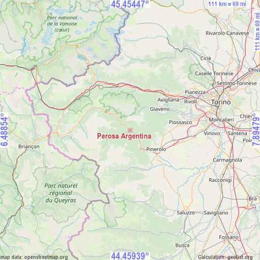
Perosa Argentina GPS coordinates[2]
44° 57' 32.724" North, 7° 11' 30.012" East
| Map corner | latitude | longitude |
|---|---|---|
| Upper-left | 45.45447°, | 6.48854° |
| Center: | 44.95909°, | 7.19167° |
| Lower-right: | 44.45939°, | 7.89479° |
| Map W x H: | 110.6×110.6 km | = 68.7×68.7mi |
| max Lat: | 47.04031° ⇑40.9% North |
| Perosa Argentina: | 44.95909° |
| min Lat: | ⇓59.1% South 35.50142° |
| min Long | Perosa Argentin | max Long |
| 6.69888° | 7.19167° | 18.48682° |
| W 0.6%⇐ | ⇒99.4% E |
Elevation
Elevation of Perosa Argentina is 641 m = 2103 ft, and this is 334.3 m = 1097 ft above average elevation for this country.
| Max E: |
2085 m = 6841 ft | 13.6% |
| Perosa Argentina | 641 m 2103 ft | |
| Avg. | 306.7 m = 1006 ft | |
Min E: |
-4 m = -13 ft | 86.4% |
See also: Italy elevation on elevation.city.
Geographical zone
Perosa Argentina is located in North temperate zone (between Tropic of Cancer and the Arctic Circle). Distance of this Northern Tropic circle is 2393.1 km =1487 mi to South.| Distance of | km | miles | from Perosa Argentina |
|---|---|---|---|
| North Pole | 5008.1 | 3111.9 | to North |
| Arctic Circle | 2402.2 | 1492.7 | to North |
| Tropic Cancer | 2393.1 | 1487 | to South |
| Equator | 4999 | 3106.2 | to South |


Nearby cities:
15 places around Perosa Argentina: (largest is in red/bold)
• Cantalupa
11 km =6.8 mi,  97°
97°
• Fleccia-Chianavasso
2.3 km =1.4 mi,  127°
127°
• Inverso Pinasca
2.6 km =1.6 mi, 125°
• Massello
10.6 km =6.6 mi,  269°
269°
• Perrero
6.6 km =4.1 mi,  249°
249°
• Pinasca-Dubbione
3.5 km =2.2 mi,  121°
121°
• Pomaretto
0.9 km =0.6 mi, 246°
• Porte
10.1 km =6.3 mi,  142°
142°
• Pramollo
5.7 km =3.5 mi,  180°
180°
• Roletto
11.7 km =7.3 mi,  109°
109°
• Roure
6.7 km =4.2 mi,  315°
315°
• Salza di Pinerolo
11.2 km =7 mi,  259°
259°
• San Germano Chisone
7.3 km =4.5 mi,  150°
150°
• San Pietro Val Lemina
11.1 km =6.9 mi, 121°
• Villar Perosa
6.3 km =3.9 mi, 135°
Sources, notices
• [Note1] Compared only with cities in Italy existing in our database
• [Src1] Map data: © OpenStreetMap contributors (CC-BY-SA)
• [Src2] Other city data from geonames.org with taken over terms of usage.
• [Src3] Geographical zone / Annual Mean Temperature by Robert A. Rohde @ Wikipedia
