Salza di Pinerolo geodata
Salza di Pinerolo (Piedmont) is a seat of a third-order administrative division; located in Italy in Europe/Rome (GMT+2) time zone. With population of 79 people, there are 11512 cities with bigger population in this country. Compared to other cities in Italy, 58.6% of cities are located further ↓South; 99.7% of cities are located further →East and 98.7% of cities have lower elevation than Salza di Pinerolo. Note1


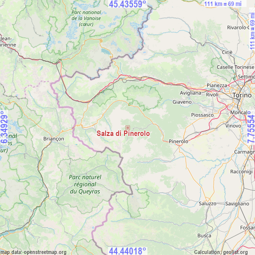
Salza di Pinerolo GPS coordinates[2]
44° 56' 24.144" North, 7° 3' 8.676" East
| Map corner | latitude | longitude |
|---|---|---|
| Upper-left | 45.43559°, | 6.34929° |
| Center: | 44.94004°, | 7.05241° |
| Lower-right: | 44.44018°, | 7.75554° |
| Map W x H: | 110.7×110.7 km | = 68.8×68.8mi |
| max Lat: | 47.04031° ⇑41.4% North |
| Salza di Pinerolo: | 44.94004° |
| min Lat: | ⇓58.6% South 35.50142° |
| min Long | Salza di Pinero | max Long |
| 6.69888° | 7.05241° | 18.48682° |
| W 0.3%⇐ | ⇒99.7% E |
Elevation
Elevation of Salza di Pinerolo is 1215 m = 3986 ft, and this is 908.3 m = 2980 ft above average elevation for this country.
| Max E: |
2085 m = 6841 ft | 1.3% |
| Salza di Pinerolo | 1215 m 3986 ft | |
| Avg. | 306.7 m = 1006 ft | |
Min E: |
-4 m = -13 ft | 98.7% |
See also: Italy elevation on elevation.city.
Geographical zone
Salza di Pinerolo is located in North temperate zone (between Tropic of Cancer and the Arctic Circle). Distance of this Northern Tropic circle is 2390.9 km =1485.6 mi to South.| Distance of | km | miles | from Salza di Pinerolo |
|---|---|---|---|
| North Pole | 5010.2 | 3113.2 | to North |
| Arctic Circle | 2404.3 | 1494 | to North |
| Tropic Cancer | 2390.9 | 1485.6 | to South |
| Equator | 4996.9 | 3104.9 | to South |


Nearby cities:
15 places around Salza di Pinerolo: (largest is in red/bold)
• Colle Sestriere
14 km =8.7 mi,  277°
277°
• Fenestrelle
10.7 km =6.6 mi,  358°
358°
• Fleccia-Chianavasso
12.8 km =8 mi,  86°
86°
• Inverso Pinasca
13.1 km =8.1 mi, 87°
• Massello
2.1 km =1.3 mi,  9°
9°
• Perosa Argentina
11.2 km =7 mi,  79°
79°
• Perrero
4.7 km =2.9 mi, 92°
• Pinasca-Dubbione
13.9 km =8.6 mi, 88°
• Pomaretto
10.3 km =6.4 mi, 80°
• Pragelato-Ruà
12 km =7.5 mi,  313°
313°
• Prali
5.6 km =3.5 mi,  180°
180°
• Pramollo
11.5 km =7.1 mi,  108°
108°
• Roure
9.3 km =5.8 mi,  42°
42°
• Sestriere
13.9 km =8.6 mi, 278°
• Usseaux
12.3 km =7.6 mi,  351°
351°
Sources, notices
• [Note1] Compared only with cities in Italy existing in our database
• [Src1] Map data: © OpenStreetMap contributors (CC-BY-SA)
• [Src2] Other city data from geonames.org with taken over terms of usage.
• [Src3] Geographical zone / Annual Mean Temperature by Robert A. Rohde @ Wikipedia
