Parabiago geodata
Parabiago (Lombardy) is a seat of a third-order administrative division; located in Italy in Europe/Rome (GMT+2) time zone. With population of 26,364 people, there are 308 cities with bigger population in this country. Compared to other cities in Italy, 75.5% of cities are located further ↓South; 82% of cities are located further →East and 57.7% of cities have higher elevation than Parabiago. Note1
Administrative division(s):
- Level 1: Lombardy
- Level 2: Città metropolitana di Milano
- Level 3: Parabiago


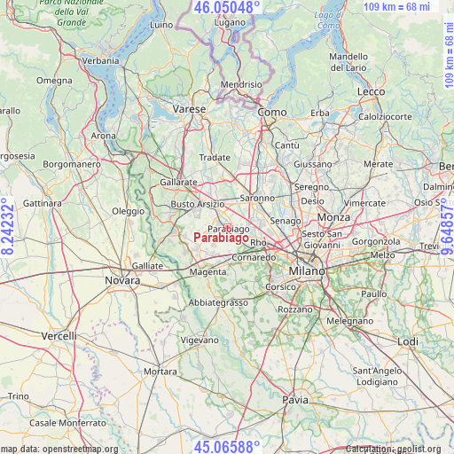
Parabiago GPS coordinates[2]
45° 33' 37.224" North, 8° 56' 43.62" East
| Map corner | latitude | longitude |
|---|---|---|
| Upper-left | 46.05048°, | 8.24232° |
| Center: | 45.56034°, | 8.94545° |
| Lower-right: | 45.06588°, | 9.64857° |
| Map W x H: | 109.5×109.5 km | = 68×68mi |
| max Lat: | 47.04031° ⇑24.5% North |
| Parabiago: | 45.56034° |
| min Lat: | ⇓75.5% South 35.50142° |
| min Long | Parabiago | max Long |
| 6.69888° | 8.94545° | 18.48682° |
| W 18%⇐ | ⇒82% E |
Elevation
Elevation of Parabiago is 182 m = 597 ft, and this is 124.7 m = 409 ft below average elevation for this country.
| Max E: |
2085 m = 6841 ft | 57.7% |
| Avg. | 306.7 m = 1006 ft | |
| Parabiago | 182 m = 597 ft | |
Min E: |
-4 m = -13 ft | 42.3% |
See also: Italy elevation on elevation.city.
Geographical zone
Parabiago is located in North temperate zone (between Tropic of Cancer and the Arctic Circle). Distance of this North polar circle is 2335.3 km =1451.1 mi to North.| Distance of | km | miles | from Parabiago |
|---|---|---|---|
| North Pole | 4941.2 | 3070.3 | to North |
| Arctic Circle | 2335.3 | 1451.1 | to North |
| Tropic Cancer | 2459.9 | 1528.5 | to South |
| Equator | 5065.8 | 3147.7 | to South |


Nearby cities:
15 places around Parabiago: (largest is in red/bold)
• Arluno
6.3 km =3.9 mi,  182°
182°
• Busto Garolfo
5.1 km =3.2 mi,  254°
254°
• Canegrate
1.7 km =1.1 mi,  301°
301°
• Cantalupo
3.5 km =2.2 mi,  55°
55°
• Casorezzo
5.4 km =3.4 mi,  219°
219°
• Cerro Maggiore
3.8 km =2.4 mi,  10°
10°
• Legnano
4.8 km =3 mi,  330°
330°
• Mantegazza
6.1 km =3.8 mi,  159°
159°
• Nerviano
2.7 km =1.7 mi,  106°
106°
• Pogliano Milanese
4.5 km =2.8 mi,  123°
123°
• Rogorotto
6.3 km =3.9 mi, 162°
• San Giorgio Su Legnano
2.9 km =1.8 mi, 301°
• San Vittore Olona
2.8 km =1.7 mi,  353°
353°
• Vanzago
5.2 km =3.2 mi,  137°
137°
• Villa Cortese
4.6 km =2.9 mi,  278°
278°
Sources, notices
• [Note1] Compared only with cities in Italy existing in our database
• [Src1] Map data: © OpenStreetMap contributors (CC-BY-SA)
• [Src2] Other city data from geonames.org with taken over terms of usage.
• [Src3] Geographical zone / Annual Mean Temperature by Robert A. Rohde @ Wikipedia
