Vanzago geodata
Vanzago (Lombardy) is a seat of a third-order administrative division; located in Italy in Europe/Rome (GMT+2) time zone. With population of 7,262 people, there are 1340 cities with bigger population in this country. Compared to other cities in Italy, 74.5% of cities are located further ↓South; 81.4% of cities are located further →East and 59.9% of cities have higher elevation than Vanzago. Note1
Administrative division(s):
- Level 1: Lombardy
- Level 2: Città metropolitana di Milano
- Level 3: Vanzago


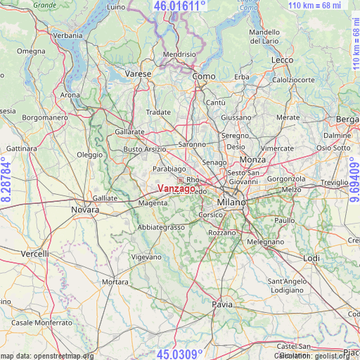
Vanzago GPS coordinates[2]
45° 31' 32.376" North, 8° 59' 27.492" East
| Map corner | latitude | longitude |
|---|---|---|
| Upper-left | 46.01611°, | 8.28784° |
| Center: | 45.52566°, | 8.99097° |
| Lower-right: | 45.0309°, | 9.69409° |
| Map W x H: | 109.5×109.5 km | = 68×68mi |
| max Lat: | 47.04031° ⇑25.5% North |
| Vanzago: | 45.52566° |
| min Lat: | ⇓74.5% South 35.50142° |
| min Long | Vanzago | max Long |
| 6.69888° | 8.99097° | 18.48682° |
| W 18.6%⇐ | ⇒81.4% E |
Elevation
Elevation of Vanzago is 164 m = 538 ft, and this is 142.7 m = 468 ft below average elevation for this country.
| Max E: |
2085 m = 6841 ft | 59.9% |
| Avg. | 306.7 m = 1006 ft | |
| Vanzago | 164 m = 538 ft | |
Min E: |
-4 m = -13 ft | 40.1% |
See also: Italy elevation on elevation.city.
Geographical zone
Vanzago is located in North temperate zone (between Tropic of Cancer and the Arctic Circle). Distance of this North polar circle is 2339.2 km =1453.5 mi to North.| Distance of | km | miles | from Vanzago |
|---|---|---|---|
| North Pole | 4945.1 | 3072.7 | to North |
| Arctic Circle | 2339.2 | 1453.5 | to North |
| Tropic Cancer | 2456.1 | 1526.1 | to South |
| Equator | 5062 | 3145.4 | to South |


Nearby cities:
15 places around Vanzago: (largest is in red/bold)
• Arluno
4.5 km =2.8 mi,  236°
236°
• Bareggio
5.2 km =3.2 mi,  174°
174°
• Cornaredo
3.9 km =2.4 mi,  134°
134°
• Lainate
5.8 km =3.6 mi,  28°
28°
• Mantegazza
2.3 km =1.4 mi,  217°
217°
• Nerviano
3.2 km =2 mi,  343°
343°
• Parabiago
5.2 km =3.2 mi,  317°
317°
• Passirana
4.8 km =3 mi,  59°
59°
• Pogliano Milanese
1.4 km =0.9 mi,  9°
9°
• Pregnana Milanese
1.7 km =1.1 mi, 130°
• Rho
3.9 km =2.4 mi,  78°
78°
• Rogorotto
2.7 km =1.7 mi, 217°
• Sedriano
4.1 km =2.5 mi,  201°
201°
• Vighignolo
5.3 km =3.3 mi, 129°
• Vittuone
5.2 km =3.2 mi, 216°
Sources, notices
• [Note1] Compared only with cities in Italy existing in our database
• [Src1] Map data: © OpenStreetMap contributors (CC-BY-SA)
• [Src2] Other city data from geonames.org with taken over terms of usage.
• [Src3] Geographical zone / Annual Mean Temperature by Robert A. Rohde @ Wikipedia
