Pantigliate geodata
Pantigliate (Lombardy) is a seat of a third-order administrative division; located in Italy in Europe/Rome (GMT+2) time zone. With population of 5,817 people, there are 1686 cities with bigger population in this country. Compared to other cities in Italy, 71.4% of cities are located further ↓South; 75.5% of cities are located further →East and 69.6% of cities have higher elevation than Pantigliate. Note1
Administrative division(s):
- Level 1: Lombardy
- Level 2: Città metropolitana di Milano
- Level 3: Pantigliate


Pantigliate GPS coordinates[2]
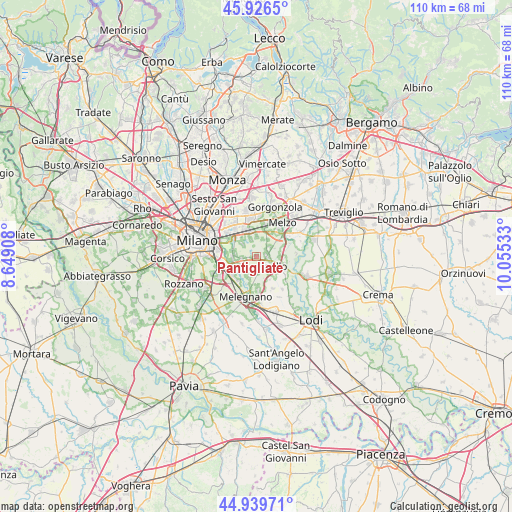
45° 26' 6.936" North, 9° 21' 7.92" East
| Map corner | latitude | longitude |
|---|---|---|
| Upper-left | 45.9265°, | 8.64908° |
| Center: | 45.43526°, | 9.3522° |
| Lower-right: | 44.93971°, | 10.05533° |
| Map W x H: | 109.7×109.7 km | = 68.2×68.2mi |
| max Lat: | 47.04031° ⇑28.6% North |
| Pantigliate: | 45.43526° |
| min Lat: | ⇓71.4% South 35.50142° |
| min Long | Pantigliate | max Long |
| 6.69888° | 9.3522° | 18.48682° |
| W 24.5%⇐ | ⇒75.5% E |
Elevation
Elevation of Pantigliate is 100 m = 328 ft, and this is 206.7 m = 678 ft below average elevation for this country.
| Max E: |
2085 m = 6841 ft | 69.6% |
| Avg. | 306.7 m = 1006 ft | |
| Pantigliate | 100 m = 328 ft | |
Min E: |
-4 m = -13 ft | 30.4% |
See also: Italy elevation on elevation.city.
Geographical zone
Pantigliate is located in North temperate zone (between Tropic of Cancer and the Arctic Circle). Distance of this North polar circle is 2349.2 km =1459.7 mi to North.| Distance of | km | miles | from Pantigliate |
|---|---|---|---|
| North Pole | 4955.1 | 3079 | to North |
| Arctic Circle | 2349.2 | 1459.7 | to North |
| Tropic Cancer | 2446 | 1519.9 | to South |
| Equator | 5051.9 | 3139.1 | to South |


Nearby cities:
15 places around Pantigliate: (largest is in red/bold)
• Bettola-Zeloforomagno
3.4 km =2.1 mi,  261°
261°
• Bustighera
4 km =2.5 mi,  190°
190°
• Caleppio
2.4 km =1.5 mi,  92°
92°
• Lucino-Rodano
4.5 km =2.8 mi,  0°
0°
• Mezzate
4.6 km =2.9 mi,  281°
281°
• Millepini
4 km =2.5 mi,  343°
343°
• Mombretto
1.6 km =1 mi,  141°
141°
• Paullo
4.2 km =2.6 mi,  116°
116°
• Premenugo
4.4 km =2.7 mi,  34°
34°
• Robbiano
3.8 km =2.4 mi,  240°
240°
• San Bovio-San Felice
4.3 km =2.7 mi,  314°
314°
• Settala
3.4 km =2.1 mi,  53°
53°
• Tribiano
3.1 km =1.9 mi, 141°
• Triginto
4.2 km =2.6 mi,  209°
209°
• Vigliano-Bettolino
0.7 km =0.4 mi,  245°
245°
Sources, notices
• [Note1] Compared only with cities in Italy existing in our database
• [Src1] Map data: © OpenStreetMap contributors (CC-BY-SA)
• [Src2] Other city data from geonames.org with taken over terms of usage.
• [Src3] Geographical zone / Annual Mean Temperature by Robert A. Rohde @ Wikipedia
