Robbiano geodata
Robbiano (Lombardy) is a populated place; located in Italy in Europe/Rome (GMT+2) time zone. With population of 976 people, there are 6754 cities with bigger population in this country. Compared to other cities in Italy, 70.8% of cities are located further ↓South; 76.2% of cities are located further →East and 69.9% of cities have higher elevation than Robbiano. Note1
Administrative division(s):
- Level 1: Lombardy
- Level 2: Città metropolitana di Milano
- Level 3: Mediglia


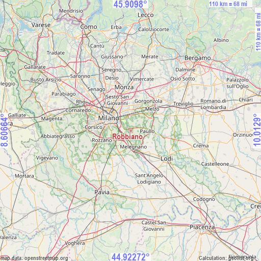
Robbiano GPS coordinates[2]
45° 25' 6.312" North, 9° 18' 35.172" East
| Map corner | latitude | longitude |
|---|---|---|
| Upper-left | 45.9098°, | 8.60664° |
| Center: | 45.41842°, | 9.30977° |
| Lower-right: | 44.92272°, | 10.0129° |
| Map W x H: | 109.8×109.8 km | = 68.2×68.2mi |
| max Lat: | 47.04031° ⇑29.2% North |
| Robbiano: | 45.41842° |
| min Lat: | ⇓70.8% South 35.50142° |
| min Long | Robbiano | max Long |
| 6.69888° | 9.30977° | 18.48682° |
| W 23.8%⇐ | ⇒76.2% E |
Elevation
Elevation of Robbiano is 98 m = 322 ft, and this is 208.7 m = 685 ft below average elevation for this country.
| Max E: |
2085 m = 6841 ft | 69.9% |
| Avg. | 306.7 m = 1006 ft | |
| Robbiano | 98 m = 322 ft | |
Min E: |
-4 m = -13 ft | 30.1% |
See also: Italy elevation on elevation.city.
Geographical zone
Robbiano is located in North temperate zone (between Tropic of Cancer and the Arctic Circle). Distance of this North polar circle is 2351.1 km =1460.9 mi to North.| Distance of | km | miles | from Robbiano |
|---|---|---|---|
| North Pole | 4957 | 3080.1 | to North |
| Arctic Circle | 2351.1 | 1460.9 | to North |
| Tropic Cancer | 2444.1 | 1518.7 | to South |
| Equator | 5050.1 | 3138 | to South |


Nearby cities:
15 places around Robbiano: (largest is in red/bold)
• Bettola-Zeloforomagno
1.4 km =0.9 mi,  356°
356°
• Bustighera
3.3 km =2.1 mi,  128°
128°
• Civesio
4.2 km =2.6 mi,  232°
232°
• Colturano
4.5 km =2.8 mi,  154°
154°
• Linate
4.3 km =2.7 mi,  317°
317°
• Mediglia
3.1 km =1.9 mi, 146°
• Mezzate
3.1 km =1.9 mi,  337°
337°
• Mombretto
4.4 km =2.7 mi,  81°
81°
• Pantigliate
3.8 km =2.4 mi,  60°
60°
• San Bovio-San Felice
4.9 km =3 mi,  2°
2°
• San Donato Milanese
3.3 km =2.1 mi,  254°
254°
• San Giuliano Milanese
3.1 km =1.9 mi,  208°
208°
• Tribiano
5.3 km =3.3 mi,  96°
96°
• Triginto
2.2 km =1.4 mi, 146°
• Vigliano-Bettolino
3.1 km =1.9 mi, 59°
Sources, notices
• [Note1] Compared only with cities in Italy existing in our database
• [Src1] Map data: © OpenStreetMap contributors (CC-BY-SA)
• [Src2] Other city data from geonames.org with taken over terms of usage.
• [Src3] Geographical zone / Annual Mean Temperature by Robert A. Rohde @ Wikipedia
