Ospitale di Cadore geodata
Ospitale di Cadore (Veneto) is a seat of a third-order administrative division; located in Italy in Europe/Rome (GMT+2) time zone. With population of 202 people, there are 11123 cities with bigger population in this country. Compared to other cities in Italy, 97.1% of cities are located further ↓South; 60.2% of cities are located further ←West and 78.4% of cities have lower elevation than Ospitale di Cadore. Note1
Administrative division(s):
- Level 1: Veneto
- Level 2: Provincia di Belluno
- Level 3: Ospitale di Cadore


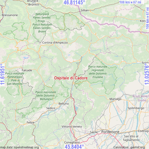
Ospitale di Cadore GPS coordinates[2]
46° 19' 41.088" North, 12° 19' 21.468" East
| Map corner | latitude | longitude |
|---|---|---|
| Upper-left | 46.81145°, | 11.61951° |
| Center: | 46.32808°, | 12.32263° |
| Lower-right: | 45.8404°, | 13.02576° |
| Map W x H: | 108×108 km | = 67.1×67.1mi |
| max Lat: | 47.04031° ⇑2.9% North |
| Ospitale di Cadore: | 46.32808° |
| min Lat: | ⇓97.1% South 35.50142° |
| min Long | Ospitale di Cad | max Long |
| 6.69888° | 12.32263° | 18.48682° |
| W 60.2%⇐ | ⇒39.8% E |
Elevation
Elevation of Ospitale di Cadore is 499 m = 1637 ft, and this is 192.3 m = 631 ft above average elevation for this country.
| Max E: |
2085 m = 6841 ft | 21.6% |
| Ospitale di Cadore | 499 m 1637 ft | |
| Avg. | 306.7 m = 1006 ft | |
Min E: |
-4 m = -13 ft | 78.4% |
See also: Italy elevation on elevation.city.
Geographical zone
Ospitale di Cadore is located in North temperate zone (between Tropic of Cancer and the Arctic Circle). Distance of this North polar circle is 2250 km =1398.1 mi to North.| Distance of | km | miles | from Ospitale di Cadore |
|---|---|---|---|
| North Pole | 4855.9 | 3017.3 | to North |
| Arctic Circle | 2250 | 1398.1 | to North |
| Tropic Cancer | 2545.3 | 1581.6 | to South |
| Equator | 5151.2 | 3200.8 | to South |


Nearby cities:
15 places around Ospitale di Cadore: (largest is in red/bold)
• Castello Lavazzo
5 km =3.1 mi,  194°
194°
• Cibiana
7.3 km =4.5 mi,  337°
337°
• Cimolais
9.9 km =6.2 mi,  116°
116°
• Codissago
5.9 km =3.7 mi, 188°
• Erto
6.9 km =4.3 mi,  146°
146°
• Forno di Zoldo
11.3 km =7 mi,  282°
282°
• Fortogna
11.2 km =7 mi, 193°
• Igne
7.8 km =4.8 mi,  206°
206°
• Longarone
7.1 km =4.4 mi, 194°
• Perarolo di Cadore
7.8 km =4.8 mi,  19°
19°
• Pieve di Cadore
11.2 km =7 mi, 16°
• Pozzale
12.5 km =7.8 mi, 15°
• Valle di Cadore
10 km =6.2 mi,  5°
5°
• Venas
9.3 km =5.8 mi,  348°
348°
• Vodo
11.7 km =7.3 mi,  329°
329°
Sources, notices
• [Note1] Compared only with cities in Italy existing in our database
• [Src1] Map data: © OpenStreetMap contributors (CC-BY-SA)
• [Src2] Other city data from geonames.org with taken over terms of usage.
• [Src3] Geographical zone / Annual Mean Temperature by Robert A. Rohde @ Wikipedia
