Cibiana geodata
Cibiana (Veneto) is a seat of a third-order administrative division; located in Italy in Europe/Rome (GMT+2) time zone. With population of 156 people, there are 11263 cities with bigger population in this country. Compared to other cities in Italy, 97.5% of cities are located further ↓South; 59.7% of cities are located further ←West and 97.3% of cities have lower elevation than Cibiana. Note1
Administrative division(s):
- Level 1: Veneto
- Level 2: Provincia di Belluno
- Level 3: Cibiana di Cadore


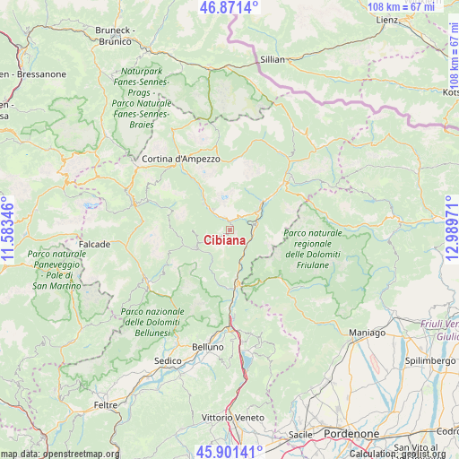
Cibiana GPS coordinates[2]
46° 23' 18.816" North, 12° 17' 11.688" East
| Map corner | latitude | longitude |
|---|---|---|
| Upper-left | 46.8714°, | 11.58346° |
| Center: | 46.38856°, | 12.28658° |
| Lower-right: | 45.90141°, | 12.98971° |
| Map W x H: | 107.9×107.9 km | = 67×67mi |
| max Lat: | 47.04031° ⇑2.5% North |
| Cibiana: | 46.38856° |
| min Lat: | ⇓97.5% South 35.50142° |
| min Long | Cibiana | max Long |
| 6.69888° | 12.28658° | 18.48682° |
| W 59.7%⇐ | ⇒40.3% E |
Elevation
Elevation of Cibiana is 1026 m = 3366 ft, and this is 719.3 m = 2360 ft above average elevation for this country.
| Max E: |
2085 m = 6841 ft | 2.7% |
| Cibiana | 1026 m 3366 ft | |
| Avg. | 306.7 m = 1006 ft | |
Min E: |
-4 m = -13 ft | 97.3% |
See also: Italy elevation on elevation.city.
Geographical zone
Cibiana is located in North temperate zone (between Tropic of Cancer and the Arctic Circle). Distance of this North polar circle is 2243.2 km =1393.9 mi to North.| Distance of | km | miles | from Cibiana |
|---|---|---|---|
| North Pole | 4849.1 | 3013.1 | to North |
| Arctic Circle | 2243.2 | 1393.9 | to North |
| Tropic Cancer | 2552 | 1585.7 | to South |
| Equator | 5157.9 | 3205 | to South |


Nearby cities:
15 places around Cibiana: (largest is in red/bold)
• Borca
7.1 km =4.4 mi,  316°
316°
• Bortolot
8.7 km =5.4 mi,  268°
268°
• Calalzo di Cadore
9.7 km =6 mi,  48°
48°
• Castello Lavazzo
11.6 km =7.2 mi,  172°
172°
• Domegge di Cadore
12 km =7.5 mi, 50°
• Forno di Zoldo
9.3 km =5.8 mi,  242°
242°
• Ospitale di Cadore
7.3 km =4.5 mi,  157°
157°
• Perarolo di Cadore
5.4 km =3.4 mi,  83°
83°
• Pieve di Cadore
7.2 km =4.5 mi,  55°
55°
• Pozzale
8 km =5 mi, 48°
• San Vito
10.3 km =6.4 mi, 323°
• Valle di Cadore
4.9 km =3 mi, 48°
• Venas
2.6 km =1.6 mi,  20°
20°
• Vodo
4.6 km =2.9 mi, 317°
• Zoppè di Cadore
8.7 km =5.4 mi, 267°
Sources, notices
• [Note1] Compared only with cities in Italy existing in our database
• [Src1] Map data: © OpenStreetMap contributors (CC-BY-SA)
• [Src2] Other city data from geonames.org with taken over terms of usage.
• [Src3] Geographical zone / Annual Mean Temperature by Robert A. Rohde @ Wikipedia
