Codissago geodata
Codissago (Veneto) is a populated place; located in Italy in Europe/Rome (GMT+2) time zone. With population of 533 people, there are 9616 cities with bigger population in this country. Compared to other cities in Italy, 96.7% of cities are located further ↓South; 60.1% of cities are located further ←West and 76.2% of cities have lower elevation than Codissago. Note1


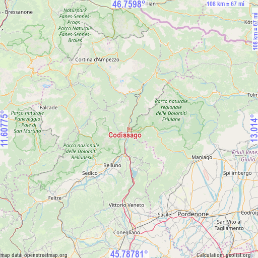
Codissago GPS coordinates[2]
46° 16' 33.456" North, 12° 18' 39.132" East
| Map corner | latitude | longitude |
|---|---|---|
| Upper-left | 46.7598°, | 11.60775° |
| Center: | 46.27596°, | 12.31087° |
| Lower-right: | 45.78781°, | 13.014° |
| Map W x H: | 108.1×108.1 km | = 67.2×67.2mi |
| max Lat: | 47.04031° ⇑3.3% North |
| Codissago: | 46.27596° |
| min Lat: | ⇓96.7% South 35.50142° |
| min Long | Codissago | max Long |
| 6.69888° | 12.31087° | 18.48682° |
| W 60.1%⇐ | ⇒39.9% E |
Elevation
Elevation of Codissago is 468 m = 1535 ft, and this is 161.3 m = 529 ft above average elevation for this country.
| Max E: |
2085 m = 6841 ft | 23.8% |
| Codissago | 468 m 1535 ft | |
| Avg. | 306.7 m = 1006 ft | |
Min E: |
-4 m = -13 ft | 76.2% |
See also: Italy elevation on elevation.city.
Geographical zone
Codissago is located in North temperate zone (between Tropic of Cancer and the Arctic Circle). Distance of this North polar circle is 2255.8 km =1401.7 mi to North.| Distance of | km | miles | from Codissago |
|---|---|---|---|
| North Pole | 4861.7 | 3020.9 | to North |
| Arctic Circle | 2255.8 | 1401.7 | to North |
| Tropic Cancer | 2539.5 | 1578 | to South |
| Equator | 5145.4 | 3197.2 | to South |


Nearby cities:
15 places around Codissago: (largest is in red/bold)
• Castello Lavazzo
1.1 km =0.7 mi,  339°
339°
• Cibiana
12.7 km =7.9 mi,  351°
351°
• Cimolais
9.9 km =6.2 mi,  81°
81°
• Erto
4.7 km =2.9 mi,  89°
89°
• Forno di Zoldo
13.1 km =8.1 mi,  309°
309°
• Fortogna
5.3 km =3.3 mi,  197°
197°
• Igne
2.8 km =1.7 mi,  244°
244°
• Lamosano
12.9 km =8 mi,  152°
152°
• Longarone
1.4 km =0.9 mi,  216°
216°
• Ospitale di Cadore
5.9 km =3.7 mi,  8°
8°
• Pieve d'Alpago
12.6 km =7.8 mi,  164°
164°
• Ponte nelle Alpi
10.8 km =6.7 mi,  191°
191°
• Ponte nelle Alpi-Polpet
10.1 km =6.3 mi, 194°
• Soccher-Paiane-Casan-Arsie
10.5 km =6.5 mi,  180°
180°
• Soverzene
8.1 km =5 mi, 184°
Sources, notices
• [Note1] Compared only with cities in Italy existing in our database
• [Src1] Map data: © OpenStreetMap contributors (CC-BY-SA)
• [Src2] Other city data from geonames.org with taken over terms of usage.
• [Src3] Geographical zone / Annual Mean Temperature by Robert A. Rohde @ Wikipedia
