Olmeneta geodata
Olmeneta (Lombardy) is a seat of a third-order administrative division; located in Italy in Europe/Rome (GMT+2) time zone. With population of 920 people, there are 7029 cities with bigger population in this country. Compared to other cities in Italy, 65.8% of cities are located further ↓South; 67.6% of cities are located further →East and 79.3% of cities have higher elevation than Olmeneta. Note1


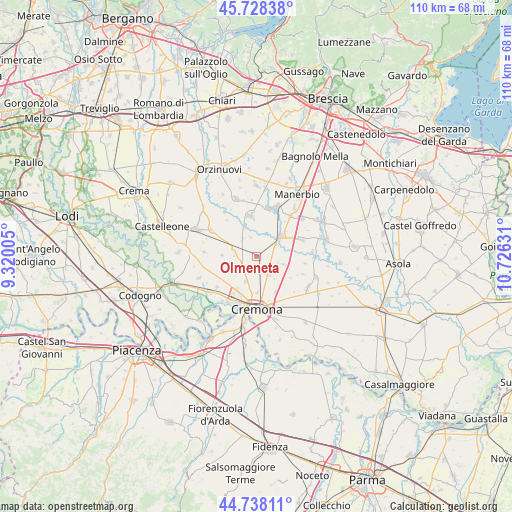
Olmeneta GPS coordinates[2]
45° 14' 7.44" North, 10° 1' 23.448" East
| Map corner | latitude | longitude |
|---|---|---|
| Upper-left | 45.72838°, | 9.32005° |
| Center: | 45.2354°, | 10.02318° |
| Lower-right: | 44.73811°, | 10.72631° |
| Map W x H: | 110.1×110.1 km | = 68.4×68.4mi |
| max Lat: | 47.04031° ⇑34.2% North |
| Olmeneta: | 45.2354° |
| min Lat: | ⇓65.8% South 35.50142° |
| min Long | Olmeneta | max Long |
| 6.69888° | 10.02318° | 18.48682° |
| W 32.4%⇐ | ⇒67.6% E |
Elevation
Elevation of Olmeneta is 53 m = 174 ft, and this is 253.7 m = 832 ft below average elevation for this country.
| Max E: |
2085 m = 6841 ft | 79.3% |
| Avg. | 306.7 m = 1006 ft | |
| Olmeneta | 53 m = 174 ft | |
Min E: |
-4 m = -13 ft | 20.7% |
See also: Italy elevation on elevation.city.
Geographical zone
Olmeneta is located in North temperate zone (between Tropic of Cancer and the Arctic Circle). Distance of this North polar circle is 2371.5 km =1473.6 mi to North.| Distance of | km | miles | from Olmeneta |
|---|---|---|---|
| North Pole | 4977.4 | 3092.8 | to North |
| Arctic Circle | 2371.5 | 1473.6 | to North |
| Tropic Cancer | 2423.8 | 1506.1 | to South |
| Equator | 5029.7 | 3125.3 | to South |


Nearby cities:
15 places around Olmeneta: (largest is in red/bold)
• Bordolano
6.9 km =4.3 mi,  335°
335°
• Boschetto
7.7 km =4.8 mi,  178°
178°
• Casalbuttano
5.2 km =3.2 mi,  290°
290°
• Castelverde
5.7 km =3.5 mi,  201°
201°
• Cignone
4.8 km =3 mi,  321°
321°
• Corte de' Cortesi
4.3 km =2.7 mi, 343°
• Corte de' Cortesi con Cignone
4.4 km =2.7 mi, 344°
• Corte de' Frati
6.4 km =4 mi,  106°
106°
• Dosimo
8.5 km =5.3 mi,  131°
131°
• Paderno Ponchielli
7.4 km =4.6 mi,  272°
272°
• Persico Dosimo
8.5 km =5.3 mi, 130°
• Pontevico
6.9 km =4.3 mi,  52°
52°
• Pozzaglio
4.6 km =2.9 mi,  148°
148°
• Pozzaglio ed Uniti
4.5 km =2.8 mi, 151°
• Robecco d'Oglio
4.9 km =3 mi,  58°
58°
Sources, notices
• [Note1] Compared only with cities in Italy existing in our database
• [Src1] Map data: © OpenStreetMap contributors (CC-BY-SA)
• [Src2] Other city data from geonames.org with taken over terms of usage.
• [Src3] Geographical zone / Annual Mean Temperature by Robert A. Rohde @ Wikipedia
