Nepezzano geodata
Nepezzano (Abruzzo) is a populated place; located in Italy in Europe/Rome (GMT+2) time zone. With population of 1,403 people, there are 5355 cities with bigger population in this country. Compared to other cities in Italy, 65.2% of cities are located further ↑North; 76.2% of cities are located further ←West and 53.2% of cities have lower elevation than Nepezzano. Note1


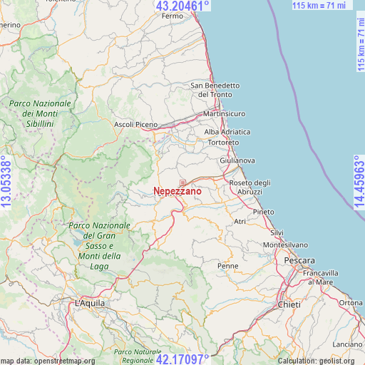
Nepezzano GPS coordinates[2]
42° 41' 23.784" North, 13° 45' 23.4" East
| Map corner | latitude | longitude |
|---|---|---|
| Upper-left | 43.20461°, | 13.05338° |
| Center: | 42.68994°, | 13.7565° |
| Lower-right: | 42.17097°, | 14.45963° |
| Map W x H: | 114.9×114.9 km | = 71.4×71.4mi |
| max Lat: | 47.04031° ⇑65.2% North |
| Nepezzano: | 42.68994° |
| min Lat: | ⇓34.8% South 35.50142° |
| min Long | Nepezzano | max Long |
| 6.69888° | 13.7565° | 18.48682° |
| W 76.2%⇐ | ⇒23.8% E |
Elevation
Elevation of Nepezzano is 254 m = 833 ft, and this is 52.7 m = 173 ft below average elevation for this country.
| Max E: |
2085 m = 6841 ft | 46.8% |
| Avg. | 306.7 m = 1006 ft | |
| Nepezzano | 254 m = 833 ft | |
Min E: |
-4 m = -13 ft | 53.2% |
See also: Italy elevation on elevation.city.
Geographical zone
Nepezzano is located in North temperate zone (between Tropic of Cancer and the Arctic Circle). Distance of this Northern Tropic circle is 2140.8 km =1330.2 mi to South.| Distance of | km | miles | from Nepezzano |
|---|---|---|---|
| North Pole | 5260.4 | 3268.7 | to North |
| Arctic Circle | 2654.5 | 1649.4 | to North |
| Tropic Cancer | 2140.8 | 1330.2 | to South |
| Equator | 4746.7 | 2949.5 | to South |


Nearby cities:
15 places around Nepezzano: (largest is in red/bold)
• Bellante
7.1 km =4.4 mi,  31°
31°
• Bellante Stazione
7 km =4.3 mi,  74°
74°
• Campli
7 km =4.3 mi,  305°
305°
• Cannelli
4.3 km =2.7 mi,  264°
264°
• Canzano
6.3 km =3.9 mi,  141°
141°
• Castellalto
5.5 km =3.4 mi,  105°
105°
• Castelnuovo
6.6 km =4.1 mi, 311°
• Colle Santa Maria-Varano
3.4 km =2.1 mi,  299°
299°
• Colleatterrato Alto
2.5 km =1.6 mi,  242°
242°
• Petriccione
6.8 km =4.2 mi,  82°
82°
• Piano d'Accio
0.7 km =0.4 mi,  171°
171°
• San Nicolò a Tordino
3.4 km =2.1 mi, 77°
• Sant'Atto
4.6 km =2.9 mi, 65°
• Teramo
5.7 km =3.5 mi, 235°
• Villa Zaccheo
7.5 km =4.7 mi, 83°
Sources, notices
• [Note1] Compared only with cities in Italy existing in our database
• [Src1] Map data: © OpenStreetMap contributors (CC-BY-SA)
• [Src2] Other city data from geonames.org with taken over terms of usage.
• [Src3] Geographical zone / Annual Mean Temperature by Robert A. Rohde @ Wikipedia
