Mozzecane geodata
Mozzecane (Veneto) is a seat of a third-order administrative division; located in Italy in Europe/Rome (GMT+2) time zone. With population of 4,394 people, there are 2192 cities with bigger population in this country. Compared to other cities in Italy, 67.6% of cities are located further ↓South; 59.5% of cities are located further →East and 80.5% of cities have higher elevation than Mozzecane. Note1


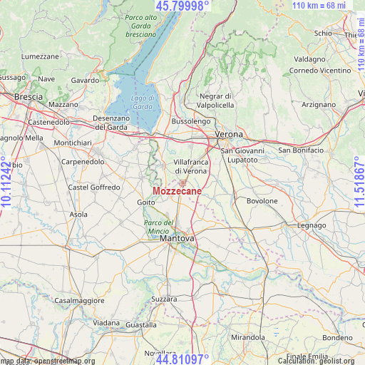
Mozzecane GPS coordinates[2]
45° 18' 27.468" North, 10° 48' 55.944" East
| Map corner | latitude | longitude |
|---|---|---|
| Upper-left | 45.79998°, | 10.11242° |
| Center: | 45.30763°, | 10.81554° |
| Lower-right: | 44.81097°, | 11.51867° |
| Map W x H: | 110×110 km | = 68.4×68.4mi |
| max Lat: | 47.04031° ⇑32.4% North |
| Mozzecane: | 45.30763° |
| min Lat: | ⇓67.6% South 35.50142° |
| min Long | Mozzecane | max Long |
| 6.69888° | 10.81554° | 18.48682° |
| W 40.5%⇐ | ⇒59.5% E |
Elevation
Elevation of Mozzecane is 47 m = 154 ft, and this is 259.7 m = 852 ft below average elevation for this country.
| Max E: |
2085 m = 6841 ft | 80.5% |
| Avg. | 306.7 m = 1006 ft | |
| Mozzecane | 47 m = 154 ft | |
Min E: |
-4 m = -13 ft | 19.5% |
See also: Italy elevation on elevation.city.
Geographical zone
Mozzecane is located in North temperate zone (between Tropic of Cancer and the Arctic Circle). Distance of this North polar circle is 2363.4 km =1468.5 mi to North.| Distance of | km | miles | from Mozzecane |
|---|---|---|---|
| North Pole | 4969.3 | 3087.8 | to North |
| Arctic Circle | 2363.4 | 1468.5 | to North |
| Tropic Cancer | 2431.8 | 1511 | to South |
| Equator | 5037.7 | 3130.3 | to South |


Nearby cities:
15 places around Mozzecane: (largest is in red/bold)
• Bagnolo
7.1 km =4.4 mi,  123°
123°
• Castiglione Mantovano
4.9 km =3 mi,  188°
188°
• Grezzano
3.5 km =2.2 mi,  73°
73°
• Malavicina
2.4 km =1.5 mi,  247°
247°
• Nogarole Rocca
5.6 km =3.5 mi,  109°
109°
• Pizzoletta
2.6 km =1.6 mi,  30°
30°
• Povegliano Veronese
6.7 km =4.2 mi,  49°
49°
• Pozzolo
7.7 km =4.8 mi,  265°
265°
• Pradelle
5.1 km =3.2 mi, 122°
• Quaderni
3.1 km =1.9 mi,  319°
319°
• Rosegaferro
4 km =2.5 mi,  352°
352°
• Roverbella
5.8 km =3.6 mi,  217°
217°
• San Zeno
1.6 km =1 mi,  39°
39°
• Villafranca di Verona
5.6 km =3.5 mi,  23°
23°
• Zona Artigianale Foroni
7.2 km =4.5 mi,  299°
299°
Sources, notices
• [Note1] Compared only with cities in Italy existing in our database
• [Src1] Map data: © OpenStreetMap contributors (CC-BY-SA)
• [Src2] Other city data from geonames.org with taken over terms of usage.
• [Src3] Geographical zone / Annual Mean Temperature by Robert A. Rohde @ Wikipedia
