Montegabbione geodata
Montegabbione (Umbria) is a seat of a third-order administrative division; located in Italy in Europe/Rome (GMT+2) time zone. With population of 628 people, there are 8785 cities with bigger population in this country. Compared to other cities in Italy, 63.9% of cities are located further ↑North; 57.2% of cities are located further ←West and 82.7% of cities have lower elevation than Montegabbione. Note1


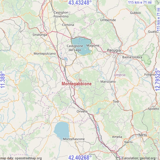
Montegabbione GPS coordinates[2]
42° 55' 11.028" North, 12° 5' 31.632" East
| Map corner | latitude | longitude |
|---|---|---|
| Upper-left | 43.43248°, | 11.389° |
| Center: | 42.91973°, | 12.09212° |
| Lower-right: | 42.40268°, | 12.79525° |
| Map W x H: | 114.5×114.5 km | = 71.1×71.1mi |
| max Lat: | 47.04031° ⇑63.9% North |
| Montegabbione: | 42.91973° |
| min Lat: | ⇓36.1% South 35.50142° |
| min Long | Montegabbione | max Long |
| 6.69888° | 12.09212° | 18.48682° |
| W 57.2%⇐ | ⇒42.8% E |
Elevation
Elevation of Montegabbione is 567 m = 1860 ft, and this is 260.3 m = 854 ft above average elevation for this country.
| Max E: |
2085 m = 6841 ft | 17.3% |
| Montegabbione | 567 m 1860 ft | |
| Avg. | 306.7 m = 1006 ft | |
Min E: |
-4 m = -13 ft | 82.7% |
See also: Italy elevation on elevation.city.
Geographical zone
Montegabbione is located in North temperate zone (between Tropic of Cancer and the Arctic Circle). Distance of this Northern Tropic circle is 2166.3 km =1346.1 mi to South.| Distance of | km | miles | from Montegabbione |
|---|---|---|---|
| North Pole | 5234.8 | 3252.8 | to North |
| Arctic Circle | 2628.9 | 1633.5 | to North |
| Tropic Cancer | 2166.3 | 1346.1 | to South |
| Equator | 4772.2 | 2965.3 | to South |


Nearby cities:
15 places around Montegabbione: (largest is in red/bold)
• Città della Pieve
8.2 km =5.1 mi,  302°
302°
• Fabro
8.2 km =5.1 mi,  230°
230°
• Fabro Scalo
6.1 km =3.8 mi,  217°
217°
• Ficulle
10 km =6.2 mi,  191°
191°
• Moiano
12.1 km =7.5 mi,  330°
330°
• Monteleone d'Orvieto
3.2 km =2 mi,  274°
274°
• Paciano
11.6 km =7.2 mi,  350°
350°
• Panicale
12.1 km =7.5 mi,  3°
3°
• Parrano
6.1 km =3.8 mi,  166°
166°
• Piegaro
5.2 km =3.2 mi, 352°
• Pietrafitta
12.6 km =7.8 mi,  51°
51°
• Po' Bandino
13.4 km =8.3 mi,  312°
312°
• Ponticelli
9.6 km =6 mi,  277°
277°
• Santa Maria
5.3 km =3.3 mi,  235°
235°
• Tavernelle
10.2 km =6.3 mi,  24°
24°
Sources, notices
• [Note1] Compared only with cities in Italy existing in our database
• [Src1] Map data: © OpenStreetMap contributors (CC-BY-SA)
• [Src2] Other city data from geonames.org with taken over terms of usage.
• [Src3] Geographical zone / Annual Mean Temperature by Robert A. Rohde @ Wikipedia
