Tavernelle geodata
Tavernelle (Umbria) is a populated place; located in Italy in Europe/Rome (GMT+2) time zone. With population of 3,177 people, there are 2911 cities with bigger population in this country. Compared to other cities in Italy, 63.4% of cities are located further ↑North; 58% of cities are located further ←West and 50.4% of cities have lower elevation than Tavernelle. Note1


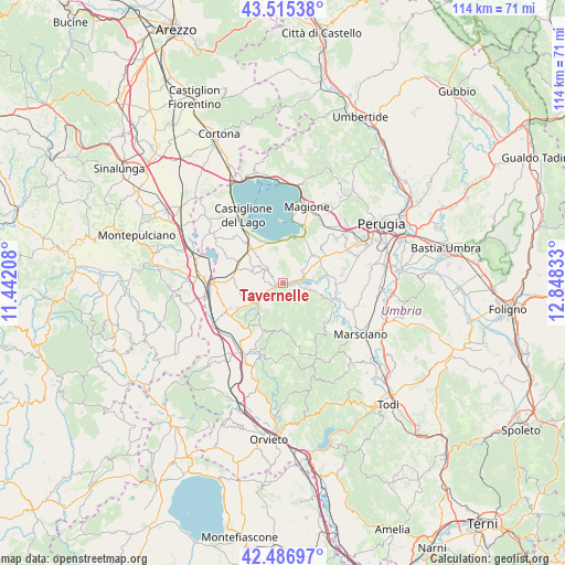
Tavernelle GPS coordinates[2]
43° 0' 11.988" North, 12° 8' 42.72" East
| Map corner | latitude | longitude |
|---|---|---|
| Upper-left | 43.51538°, | 11.44208° |
| Center: | 43.00333°, | 12.1452° |
| Lower-right: | 42.48697°, | 12.84833° |
| Map W x H: | 114.3×114.3 km | = 71×71mi |
| max Lat: | 47.04031° ⇑63.4% North |
| Tavernelle: | 43.00333° |
| min Lat: | ⇓36.6% South 35.50142° |
| min Long | Tavernelle | max Long |
| 6.69888° | 12.1452° | 18.48682° |
| W 58%⇐ | ⇒42% E |
Elevation
Elevation of Tavernelle is 237 m = 778 ft, and this is 69.7 m = 229 ft below average elevation for this country.
| Max E: |
2085 m = 6841 ft | 49.6% |
| Avg. | 306.7 m = 1006 ft | |
| Tavernelle | 237 m = 778 ft | |
Min E: |
-4 m = -13 ft | 50.4% |
See also: Italy elevation on elevation.city.
Geographical zone
Tavernelle is located in North temperate zone (between Tropic of Cancer and the Arctic Circle). Distance of this Northern Tropic circle is 2175.6 km =1351.9 mi to South.| Distance of | km | miles | from Tavernelle |
|---|---|---|---|
| North Pole | 5225.5 | 3247 | to North |
| Arctic Circle | 2619.7 | 1627.8 | to North |
| Tropic Cancer | 2175.6 | 1351.9 | to South |
| Equator | 4781.5 | 2971.1 | to South |


Nearby cities:
15 places around Tavernelle: (largest is in red/bold)
• Agello
10.7 km =6.6 mi,  45°
45°
• Castiglione della Valle
8.8 km =5.5 mi,  77°
77°
• Fontignano
4.5 km =2.8 mi,  58°
58°
• Macchie
8.7 km =5.4 mi,  316°
316°
• Moiano
10.4 km =6.5 mi,  276°
276°
• Montegabbione
10.2 km =6.3 mi,  204°
204°
• Mugnano
8.4 km =5.2 mi, 46°
• Paciano
6.7 km =4.2 mi,  289°
289°
• Panicale
4.6 km =2.9 mi,  307°
307°
• Panicarola
8.8 km =5.5 mi,  326°
326°
• Piegaro
6.5 km =4 mi,  230°
230°
• Pietrafitta
5.7 km =3.5 mi,  103°
103°
• San Fatucchio
11.1 km =6.9 mi, 317°
• Sant'Arcangelo
9.1 km =5.7 mi,  7°
7°
• Spina
11.2 km =7 mi, 100°
Sources, notices
• [Note1] Compared only with cities in Italy existing in our database
• [Src1] Map data: © OpenStreetMap contributors (CC-BY-SA)
• [Src2] Other city data from geonames.org with taken over terms of usage.
• [Src3] Geographical zone / Annual Mean Temperature by Robert A. Rohde @ Wikipedia
