Montale geodata
Montale (Emilia-Romagna) is a populated place; located in Italy in Europe/Rome (GMT+2) time zone. With population of 4,066 people, there are 2360 cities with bigger population in this country. Compared to other cities in Italy, 52% of cities are located further ↓South; 58.4% of cities are located further →East and 76.5% of cities have higher elevation than Montale. Note1
Administrative division(s):
- Level 1: Emilia-Romagna
- Level 2: Provincia di Modena
- Level 3: Castelnuovo Rangone


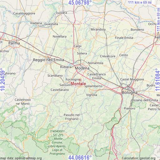
Montale GPS coordinates[2]
44° 34' 9.228" North, 10° 54' 27.756" East
| Map corner | latitude | longitude |
|---|---|---|
| Upper-left | 45.06798°, | 10.20459° |
| Center: | 44.56923°, | 10.90771° |
| Lower-right: | 44.06616°, | 11.61084° |
| Map W x H: | 111.4×111.4 km | = 69.2×69.2mi |
| max Lat: | 47.04031° ⇑48% North |
| Montale: | 44.56923° |
| min Lat: | ⇓52% South 35.50142° |
| min Long | Montale | max Long |
| 6.69888° | 10.90771° | 18.48682° |
| W 41.6%⇐ | ⇒58.4% E |
Elevation
Elevation of Montale is 67 m = 220 ft, and this is 239.7 m = 786 ft below average elevation for this country.
| Max E: |
2085 m = 6841 ft | 76.5% |
| Avg. | 306.7 m = 1006 ft | |
| Montale | 67 m = 220 ft | |
Min E: |
-4 m = -13 ft | 23.5% |
See also: Italy elevation on elevation.city.
Geographical zone
Montale is located in North temperate zone (between Tropic of Cancer and the Arctic Circle). Distance of this Northern Tropic circle is 2349.7 km =1460 mi to South.| Distance of | km | miles | from Montale |
|---|---|---|---|
| North Pole | 5051.4 | 3138.8 | to North |
| Arctic Circle | 2445.5 | 1519.6 | to North |
| Tropic Cancer | 2349.7 | 1460 | to South |
| Equator | 4955.6 | 3079.3 | to South |


Nearby cities:
15 places around Montale: (largest is in red/bold)
• Baggiovara
5.3 km =3.3 mi,  317°
317°
• Ca' di Sola
5.7 km =3.5 mi,  139°
139°
• Castelnuovo Rangone
3 km =1.9 mi, 137°
• Castelvetro di Modena
7.9 km =4.9 mi,  156°
156°
• Colombaro
2.2 km =1.4 mi,  204°
204°
• Formigine
4.8 km =3 mi,  274°
274°
• Gorzano
6.3 km =3.9 mi, 200°
• Maranello
5.2 km =3.2 mi,  215°
215°
• Portile
2.7 km =1.7 mi,  60°
60°
• Pozza
4.9 km =3 mi,  194°
194°
• San Damaso
6.3 km =3.9 mi, 55°
• San Donnino
4.9 km =3 mi,  71°
71°
• San Vito
5.4 km =3.4 mi,  103°
103°
• Solignano Nuovo
4.9 km =3 mi, 162°
• Torre Maina
8.3 km =5.2 mi, 199°
Sources, notices
• [Note1] Compared only with cities in Italy existing in our database
• [Src1] Map data: © OpenStreetMap contributors (CC-BY-SA)
• [Src2] Other city data from geonames.org with taken over terms of usage.
• [Src3] Geographical zone / Annual Mean Temperature by Robert A. Rohde @ Wikipedia
