Formigine geodata
Formigine (Emilia-Romagna) is a seat of a third-order administrative division; located in Italy in Europe/Rome (GMT+2) time zone. With population of 26,324 people, there are 309 cities with bigger population in this country. Compared to other cities in Italy, 52.1% of cities are located further ↓South; 59.2% of cities are located further →East and 73.3% of cities have higher elevation than Formigine. Note1


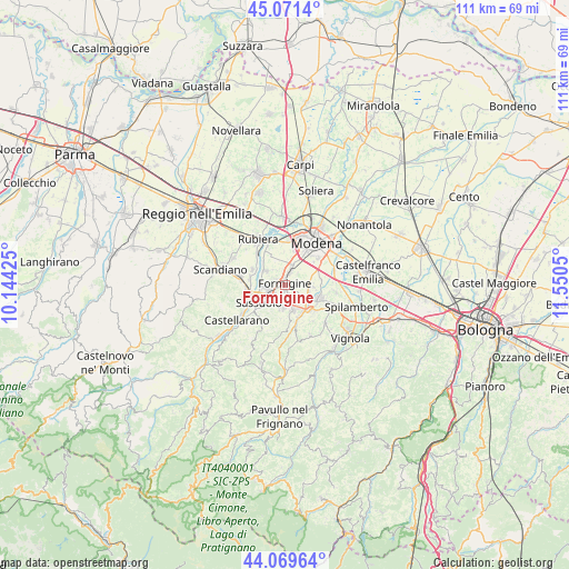
Formigine GPS coordinates[2]
44° 34' 21.648" North, 10° 50' 50.532" East
| Map corner | latitude | longitude |
|---|---|---|
| Upper-left | 45.0714°, | 10.14425° |
| Center: | 44.57268°, | 10.84737° |
| Lower-right: | 44.06964°, | 11.5505° |
| Map W x H: | 111.4×111.4 km | = 69.2×69.2mi |
| max Lat: | 47.04031° ⇑47.9% North |
| Formigine: | 44.57268° |
| min Lat: | ⇓52.1% South 35.50142° |
| min Long | Formigine | max Long |
| 6.69888° | 10.84737° | 18.48682° |
| W 40.8%⇐ | ⇒59.2% E |
Elevation
Elevation of Formigine is 82 m = 269 ft, and this is 224.7 m = 737 ft below average elevation for this country.
| Max E: |
2085 m = 6841 ft | 73.3% |
| Avg. | 306.7 m = 1006 ft | |
| Formigine | 82 m = 269 ft | |
Min E: |
-4 m = -13 ft | 26.7% |
See also: Italy elevation on elevation.city.
Geographical zone
Formigine is located in North temperate zone (between Tropic of Cancer and the Arctic Circle). Distance of this Northern Tropic circle is 2350.1 km =1460.3 mi to South.| Distance of | km | miles | from Formigine |
|---|---|---|---|
| North Pole | 5051 | 3138.5 | to North |
| Arctic Circle | 2445.2 | 1519.4 | to North |
| Tropic Cancer | 2350.1 | 1460.3 | to South |
| Equator | 4956 | 3079.5 | to South |


Nearby cities:
15 places around Formigine: (largest is in red/bold)
• Baggiovara
3.7 km =2.3 mi,  18°
18°
• Castelnuovo Rangone
7.3 km =4.5 mi,  110°
110°
• Colombaro
4.5 km =2.8 mi,  121°
121°
• Fiorano
4.7 km =2.9 mi,  216°
216°
• Gorzano
6.8 km =4.2 mi,  157°
157°
• Magreta
4.8 km =3 mi,  309°
309°
• Maranello
4.9 km =3 mi, 159°
• Montale
4.8 km =3 mi,  94°
94°
• Portile
7.2 km =4.5 mi,  82°
82°
• Pozza
6.3 km =3.9 mi,  145°
145°
• Salvaterra
6.9 km =4.3 mi,  295°
295°
• San Venanzio
8.2 km =5.1 mi,  174°
174°
• Sassuolo
5.9 km =3.7 mi,  236°
236°
• Solignano Nuovo
8 km =5 mi,  128°
128°
• Veggia-Villalunga
7.3 km =4.5 mi,  259°
259°
Sources, notices
• [Note1] Compared only with cities in Italy existing in our database
• [Src1] Map data: © OpenStreetMap contributors (CC-BY-SA)
• [Src2] Other city data from geonames.org with taken over terms of usage.
• [Src3] Geographical zone / Annual Mean Temperature by Robert A. Rohde @ Wikipedia
