Montà geodata
Montà (Piedmont) is a seat of a third-order administrative division; located in Italy in Europe/Rome (GMT+2) time zone. With population of 3,512 people, there are 2670 cities with bigger population in this country. Compared to other cities in Italy, 56.5% of cities are located further ↓South; 94.1% of cities are located further →East and 61.4% of cities have lower elevation than Montà. Note1


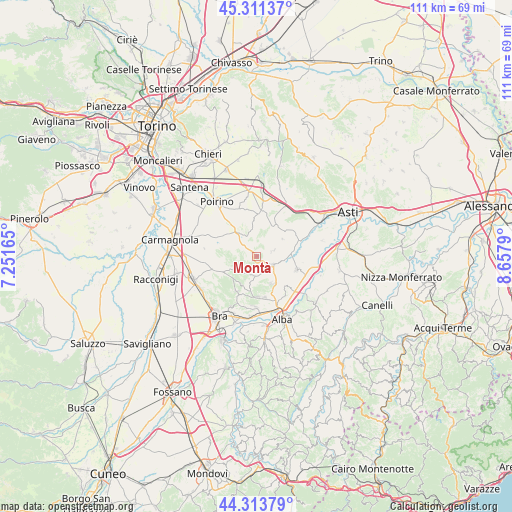
Montà GPS coordinates[2]
44° 48' 53.064" North, 7° 57' 17.172" East
| Map corner | latitude | longitude |
|---|---|---|
| Upper-left | 45.31137°, | 7.25165° |
| Center: | 44.81474°, | 7.95477° |
| Lower-right: | 44.31379°, | 8.6579° |
| Map W x H: | 110.9×110.9 km | = 68.9×68.9mi |
| max Lat: | 47.04031° ⇑43.5% North |
| Montà: | 44.81474° |
| min Lat: | ⇓56.5% South 35.50142° |
| min Long | Montà | max Long |
| 6.69888° | 7.95477° | 18.48682° |
| W 5.9%⇐ | ⇒94.1% E |
Elevation
Elevation of Montà is 310 m = 1017 ft, and this is 3.3 m = 11 ft above average elevation for this country.
| Max E: |
2085 m = 6841 ft | 38.6% |
| Montà | 310 m 1017 ft | |
| Avg. | 306.7 m = 1006 ft | |
Min E: |
-4 m = -13 ft | 61.4% |
See also: Italy elevation on elevation.city.
Geographical zone
Montà is located in North temperate zone (between Tropic of Cancer and the Arctic Circle). Distance of this Northern Tropic circle is 2377 km =1477 mi to South.| Distance of | km | miles | from Montà |
|---|---|---|---|
| North Pole | 5024.1 | 3121.8 | to North |
| Arctic Circle | 2418.2 | 1502.6 | to North |
| Tropic Cancer | 2377 | 1477 | to South |
| Equator | 4982.9 | 3096.2 | to South |


Nearby cities:
15 places around Montà: (largest is in red/bold)
• Baldissero d'Alba
6.9 km =4.3 mi,  211°
211°
• Canale
3.8 km =2.4 mi,  125°
125°
• Castellinaldo
7.4 km =4.6 mi, 126°
• Cellarengo
5.6 km =3.5 mi,  352°
352°
• Cisterna d'Asti
3.8 km =2.4 mi,  72°
72°
• Corneliano d'Alba
8.7 km =5.4 mi,  178°
178°
• Ferrere
7.5 km =4.7 mi,  24°
24°
• Montaldo Roero
5.7 km =3.5 mi,  204°
204°
• Monteu Roero
4.1 km =2.5 mi, 203°
• Pralormo
6.4 km =4 mi,  321°
321°
• San Damiano d'Asti
8.8 km =5.5 mi,  76°
76°
• Santo Stefano Roero
3.1 km =1.9 mi, 200°
• Sommariva Perno
8.8 km =5.5 mi, 209°
• Vezza d'Alba
7.1 km =4.4 mi,  144°
144°
• Villa
8.7 km =5.4 mi, 209°
Sources, notices
• [Note1] Compared only with cities in Italy existing in our database
• [Src1] Map data: © OpenStreetMap contributors (CC-BY-SA)
• [Src2] Other city data from geonames.org with taken over terms of usage.
• [Src3] Geographical zone / Annual Mean Temperature by Robert A. Rohde @ Wikipedia
