Marlengo geodata
Marlengo (Trentino-Alto Adige) is a seat of a third-order administrative division; located in Italy in Europe/Rome (GMT+2) time zone. With population of 1,942 people, there are 4260 cities with bigger population in this country. Compared to other cities in Italy, 99.1% of cities are located further ↓South; 55.2% of cities are located further →East and 58.4% of cities have lower elevation than Marlengo. Note1


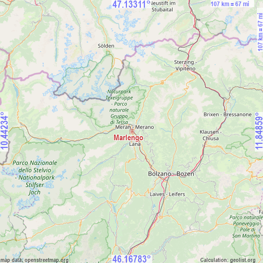
Marlengo GPS coordinates[2]
46° 39' 9.432" North, 11° 8' 43.656" East
| Map corner | latitude | longitude |
|---|---|---|
| Upper-left | 47.13311°, | 10.44234° |
| Center: | 46.65262°, | 11.14546° |
| Lower-right: | 46.16783°, | 11.84859° |
| Map W x H: | 107.3×107.3 km | = 66.7×66.7mi |
| max Lat: | 47.04031° ⇑0.9% North |
| Marlengo: | 46.65262° |
| min Lat: | ⇓99.1% South 35.50142° |
| min Long | Marlengo | max Long |
| 6.69888° | 11.14546° | 18.48682° |
| W 44.8%⇐ | ⇒55.2% E |
Elevation
Elevation of Marlengo is 288 m = 945 ft, and this is 18.7 m = 61 ft below average elevation for this country.
| Max E: |
2085 m = 6841 ft | 41.6% |
| Avg. | 306.7 m = 1006 ft | |
| Marlengo | 288 m = 945 ft | |
Min E: |
-4 m = -13 ft | 58.4% |
See also: Italy elevation on elevation.city.
Geographical zone
Marlengo is located in North temperate zone (between Tropic of Cancer and the Arctic Circle). Distance of this North polar circle is 2213.9 km =1375.7 mi to North.| Distance of | km | miles | from Marlengo |
|---|---|---|---|
| North Pole | 4819.8 | 2994.9 | to North |
| Arctic Circle | 2213.9 | 1375.7 | to North |
| Tropic Cancer | 2581.4 | 1604 | to South |
| Equator | 5187.3 | 3223.2 | to South |


Nearby cities:
15 places around Marlengo: (largest is in red/bold)
• Avelengo
6.1 km =3.8 mi,  97°
97°
• Caines
5.4 km =3.4 mi,  21°
21°
• Caines - Kuens
5.6 km =3.5 mi, 19°
• Cermes
2.2 km =1.4 mi,  177°
177°
• Lagundo
3.5 km =2.2 mi,  334°
334°
• Lana
4.6 km =2.9 mi,  169°
169°
• Merano
2 km =1.2 mi,  31°
31°
• Postal
6 km =3.7 mi,  142°
142°
• Rablà
6.5 km =4 mi,  287°
287°
• Rifiano
6.2 km =3.9 mi, 25°
• Scena
5.2 km =3.2 mi,  39°
39°
• Scena - Schenna
5.2 km =3.2 mi, 36°
• Sinigo
3.2 km =2 mi,  127°
127°
• Tirolo
4.3 km =2.7 mi,  8°
8°
• Zona Laurin
2.8 km =1.7 mi,  358°
358°
Sources, notices
• [Note1] Compared only with cities in Italy existing in our database
• [Src1] Map data: © OpenStreetMap contributors (CC-BY-SA)
• [Src2] Other city data from geonames.org with taken over terms of usage.
• [Src3] Geographical zone / Annual Mean Temperature by Robert A. Rohde @ Wikipedia
