Rablà geodata
Rablà (Trentino-Alto Adige) is a populated place; located in Italy in Europe/Rome (GMT+2) time zone. With population of 1,480 people, there are 5162 cities with bigger population in this country. Compared to other cities in Italy, 99.2% of cities are located further ↓South; 56.4% of cities are located further →East and 80.6% of cities have lower elevation than Rablà. Note1
Administrative division(s):
- Level 1: Trentino-Alto Adige
- Level 2: Bolzano
- Level 3: Partschins - Parcines


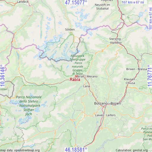
Rablà GPS coordinates[2]
46° 40' 13.584" North, 11° 3' 52.488" East
| Map corner | latitude | longitude |
|---|---|---|
| Upper-left | 47.15077°, | 10.36146° |
| Center: | 46.67044°, | 11.06458° |
| Lower-right: | 46.18581°, | 11.76771° |
| Map W x H: | 107.3×107.3 km | = 66.7×66.7mi |
| max Lat: | 47.04031° ⇑0.8% North |
| Rablà: | 46.67044° |
| min Lat: | ⇓99.2% South 35.50142° |
| min Long | Rablà | max Long |
| 6.69888° | 11.06458° | 18.48682° |
| W 43.6%⇐ | ⇒56.4% E |
Elevation
Elevation of Rablà is 534 m = 1752 ft, and this is 227.3 m = 746 ft above average elevation for this country.
| Max E: |
2085 m = 6841 ft | 19.4% |
| Rablà | 534 m 1752 ft | |
| Avg. | 306.7 m = 1006 ft | |
Min E: |
-4 m = -13 ft | 80.6% |
See also: Italy elevation on elevation.city.
Geographical zone
Rablà is located in North temperate zone (between Tropic of Cancer and the Arctic Circle). Distance of this North polar circle is 2211.9 km =1374.4 mi to North.| Distance of | km | miles | from Rablà |
|---|---|---|---|
| North Pole | 4817.8 | 2993.6 | to North |
| Arctic Circle | 2211.9 | 1374.4 | to North |
| Tropic Cancer | 2583.3 | 1605.2 | to South |
| Equator | 5189.3 | 3224.5 | to South |


Nearby cities:
15 places around Rablà: (largest is in red/bold)
• Caines
8.7 km =5.4 mi,  69°
69°
• Caines - Kuens
8.7 km =5.4 mi, 67°
• Cermes
7.6 km =4.7 mi,  123°
123°
• Lagundo
4.8 km =3 mi,  75°
75°
• Marlengo
6.5 km =4 mi,  107°
107°
• Merano
7.2 km =4.5 mi,  91°
91°
• Naturno
5.4 km =3.4 mi,  242°
242°
• Parcines
1.7 km =1.1 mi,  23°
23°
• Plaus
2.4 km =1.5 mi,  227°
227°
• Rifiano
9.6 km =6 mi, 67°
• San Pancrazio
9.5 km =5.9 mi,  170°
170°
• Scena - Schenna
9.5 km =5.9 mi, 76°
• Sinigo
9.6 km =6 mi, 114°
• Tirolo
7.2 km =4.5 mi, 71°
• Zona Laurin
6.2 km =3.9 mi, 81°
Sources, notices
• [Note1] Compared only with cities in Italy existing in our database
• [Src1] Map data: © OpenStreetMap contributors (CC-BY-SA)
• [Src2] Other city data from geonames.org with taken over terms of usage.
• [Src3] Geographical zone / Annual Mean Temperature by Robert A. Rohde @ Wikipedia
