Marcaria geodata
Marcaria (Lombardy) is a seat of a third-order administrative division; located in Italy in Europe/Rome (GMT+2) time zone. With population of 863 people, there are 7351 cities with bigger population in this country. Compared to other cities in Italy, 63% of cities are located further ↓South; 62.5% of cities are located further →East and 86.4% of cities have higher elevation than Marcaria. Note1


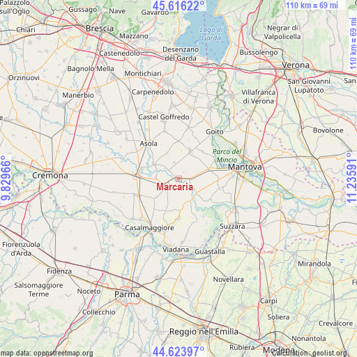
Marcaria GPS coordinates[2]
45° 7' 20.1" North, 10° 31' 58.008" East
| Map corner | latitude | longitude |
|---|---|---|
| Upper-left | 45.61622°, | 9.82966° |
| Center: | 45.12225°, | 10.53278° |
| Lower-right: | 44.62397°, | 11.23591° |
| Map W x H: | 110.3×110.3 km | = 68.5×68.5mi |
| max Lat: | 47.04031° ⇑37% North |
| Marcaria: | 45.12225° |
| min Lat: | ⇓63% South 35.50142° |
| min Long | Marcaria | max Long |
| 6.69888° | 10.53278° | 18.48682° |
| W 37.5%⇐ | ⇒62.5% E |
Elevation
Elevation of Marcaria is 27 m = 89 ft, and this is 279.7 m = 918 ft below average elevation for this country.
| Max E: |
2085 m = 6841 ft | 86.4% |
| Avg. | 306.7 m = 1006 ft | |
| Marcaria | 27 m = 89 ft | |
Min E: |
-4 m = -13 ft | 13.6% |
See also: Italy elevation on elevation.city.
Geographical zone
Marcaria is located in North temperate zone (between Tropic of Cancer and the Arctic Circle). Distance of this North polar circle is 2384.1 km =1481.4 mi to North.| Distance of | km | miles | from Marcaria |
|---|---|---|---|
| North Pole | 4989.9 | 3100.6 | to North |
| Arctic Circle | 2384.1 | 1481.4 | to North |
| Tropic Cancer | 2411.2 | 1498.2 | to South |
| Equator | 5017.1 | 3117.5 | to South |


Nearby cities:
15 places around Marcaria: (largest is in red/bold)
• Acquanegra sul Chiese
9.1 km =5.7 mi,  300°
300°
• Belforte
5.1 km =3.2 mi,  153°
153°
• Bozzolo
4.7 km =2.9 mi,  243°
243°
• Calvatone
7.3 km =4.5 mi,  274°
274°
• Campitello
6.9 km =4.3 mi,  123°
123°
• Commessaggio
9.5 km =5.9 mi,  174°
174°
• Gazoldo degli Ippoliti
9.4 km =5.8 mi,  22°
22°
• Gazzuolo
7.3 km =4.5 mi,  155°
155°
• Mariana Mantovana
8.6 km =5.3 mi,  335°
335°
• Redondesco
5.2 km =3.2 mi, 341°
• Rivarolo Mantovano
9.3 km =5.8 mi,  233°
233°
• San Martino Dall'Argine
3 km =1.9 mi,  203°
203°
• San Michele in Bosco
3.2 km =2 mi,  110°
110°
• Spineda
7 km =4.3 mi,  193°
193°
• Tornata
8.2 km =5.1 mi,  256°
256°
Sources, notices
• [Note1] Compared only with cities in Italy existing in our database
• [Src1] Map data: © OpenStreetMap contributors (CC-BY-SA)
• [Src2] Other city data from geonames.org with taken over terms of usage.
• [Src3] Geographical zone / Annual Mean Temperature by Robert A. Rohde @ Wikipedia
