Malmantile geodata
Malmantile (Tuscany) is a populated place; located in Italy in Europe/Rome (GMT+2) time zone. With population of 1,327 people, there are 5549 cities with bigger population in this country. Compared to other cities in Italy, 57.6% of cities are located further ↑North; 56.3% of cities are located further →East and 55.5% of cities have higher elevation than Malmantile. Note1


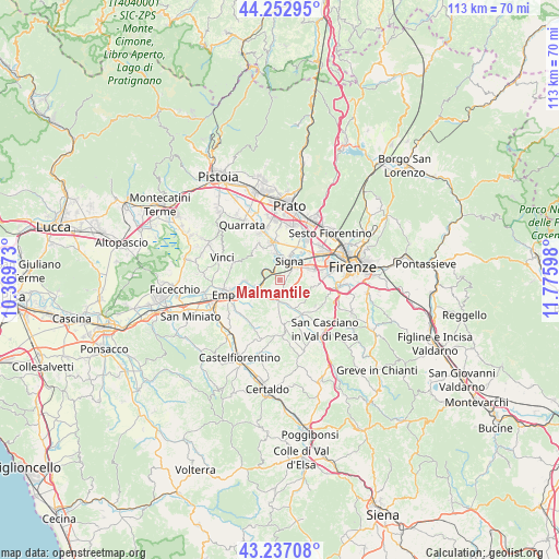
Malmantile GPS coordinates[2]
43° 44' 49.812" North, 11° 4' 22.26" East
| Map corner | latitude | longitude |
|---|---|---|
| Upper-left | 44.25295°, | 10.36973° |
| Center: | 43.74717°, | 11.07285° |
| Lower-right: | 43.23708°, | 11.77598° |
| Map W x H: | 113×113 km | = 70.2×70.2mi |
| max Lat: | 47.04031° ⇑57.6% North |
| Malmantile: | 43.74717° |
| min Lat: | ⇓42.4% South 35.50142° |
| min Long | Malmantile | max Long |
| 6.69888° | 11.07285° | 18.48682° |
| W 43.7%⇐ | ⇒56.3% E |
Elevation
Elevation of Malmantile is 199 m = 653 ft, and this is 107.7 m = 353 ft below average elevation for this country.
| Max E: |
2085 m = 6841 ft | 55.5% |
| Avg. | 306.7 m = 1006 ft | |
| Malmantile | 199 m = 653 ft | |
Min E: |
-4 m = -13 ft | 44.5% |
See also: Italy elevation on elevation.city.
Geographical zone
Malmantile is located in North temperate zone (between Tropic of Cancer and the Arctic Circle). Distance of this Northern Tropic circle is 2258.3 km =1403.2 mi to South.| Distance of | km | miles | from Malmantile |
|---|---|---|---|
| North Pole | 5142.8 | 3195.6 | to North |
| Arctic Circle | 2536.9 | 1576.4 | to North |
| Tropic Cancer | 2258.3 | 1403.2 | to South |
| Equator | 4864.2 | 3022.5 | to South |


Nearby cities:
15 places around Malmantile: (largest is in red/bold)
• Capraia e Limite
7.2 km =4.5 mi,  268°
268°
• Cerbaia
8.2 km =5.1 mi,  146°
146°
• Comeana
5.3 km =3.3 mi,  347°
347°
• Ginestra Fiorentina
4.2 km =2.6 mi,  178°
178°
• Lastra a Signa
4.1 km =2.5 mi,  51°
51°
• Limite
7.5 km =4.7 mi, 267°
• Montelupo Fiorentino
5.4 km =3.4 mi,  248°
248°
• Poggio A Caiano
7.6 km =4.7 mi, 347°
• Quattro Strade
0.9 km =0.6 mi,  135°
135°
• San Donnino
8 km =5 mi, 47°
• San Martino alla Palma
5.7 km =3.5 mi,  87°
87°
• San Mauro
6.7 km =4.2 mi,  38°
38°
• San Vincenzo a Torri
5.5 km =3.4 mi,  160°
160°
• Serra
7 km =4.3 mi,  331°
331°
• Signa
5.8 km =3.6 mi,  25°
25°
Sources, notices
• [Note1] Compared only with cities in Italy existing in our database
• [Src1] Map data: © OpenStreetMap contributors (CC-BY-SA)
• [Src2] Other city data from geonames.org with taken over terms of usage.
• [Src3] Geographical zone / Annual Mean Temperature by Robert A. Rohde @ Wikipedia
