Luserna geodata
Luserna (Trentino-Alto Adige) is a seat of a third-order administrative division; located in Italy in Europe/Rome (GMT+2) time zone. With population of 275 people, there are 10778 cities with bigger population in this country. Compared to other cities in Italy, 89.9% of cities are located further ↓South; 52.8% of cities are located further →East and 99.2% of cities have lower elevation than Luserna. Note1
Administrative division(s):
- Level 1: Trentino-Alto Adige
- Level 2: Provincia autonoma di Trento
- Level 3: Luserna


Luserna GPS coordinates[2]
45° 55' 21.36" North, 11° 19' 22.404" East
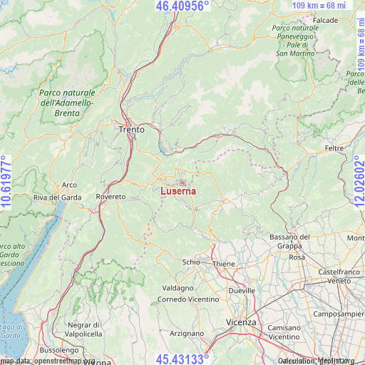
| Map corner | latitude | longitude |
|---|---|---|
| Upper-left | 46.40956°, | 10.61977° |
| Center: | 45.9226°, | 11.32289° |
| Lower-right: | 45.43133°, | 12.02602° |
| Map W x H: | 108.8×108.8 km | = 67.6×67.6mi |
| max Lat: | 47.04031° ⇑10.1% North |
| Luserna: | 45.9226° |
| min Lat: | ⇓89.9% South 35.50142° |
| min Long | Luserna | max Long |
| 6.69888° | 11.32289° | 18.48682° |
| W 47.2%⇐ | ⇒52.8% E |
Elevation
Elevation of Luserna is 1334 m = 4377 ft, and this is 1027.3 m = 3370 ft above average elevation for this country.
| Max E: |
2085 m = 6841 ft | 0.8% |
| Luserna | 1334 m 4377 ft | |
| Avg. | 306.7 m = 1006 ft | |
Min E: |
-4 m = -13 ft | 99.2% |
See also: Italy elevation on elevation.city.
Geographical zone
Luserna is located in North temperate zone (between Tropic of Cancer and the Arctic Circle). Distance of this North polar circle is 2295.1 km =1426.1 mi to North.| Distance of | km | miles | from Luserna |
|---|---|---|---|
| North Pole | 4900.9 | 3045.3 | to North |
| Arctic Circle | 2295.1 | 1426.1 | to North |
| Tropic Cancer | 2500.2 | 1553.6 | to South |
| Equator | 5106.1 | 3172.8 | to South |


Nearby cities:
15 places around Luserna: (largest is in red/bold)
• Barco
9.1 km =5.7 mi,  7°
7°
• Calceranica al Lago
11 km =6.8 mi,  326°
326°
• Caldonazzo
9.1 km =5.7 mi, 330°
• Centa San Nicolò
8.7 km =5.4 mi,  306°
306°
• Gionghi-Cappella
4 km =2.5 mi,  292°
292°
• Lastebasse
3.9 km =2.4 mi,  257°
257°
• Levico Terme
10.1 km =6.3 mi,  351°
351°
• Longhi
1.9 km =1.2 mi,  207°
207°
• Pedemonte
1.9 km =1.2 mi,  215°
215°
• Roana
11.3 km =7 mi,  116°
116°
• Rotzo
8.8 km =5.5 mi,  139°
139°
• San Pietro Valdastico
5 km =3.1 mi, 143°
• Tenna
11.3 km =7 mi,  336°
336°
• Tonezza del Cimone
7.3 km =4.5 mi,  165°
165°
• Vattaro
11.3 km =7 mi, 314°
Sources, notices
• [Note1] Compared only with cities in Italy existing in our database
• [Src1] Map data: © OpenStreetMap contributors (CC-BY-SA)
• [Src2] Other city data from geonames.org with taken over terms of usage.
• [Src3] Geographical zone / Annual Mean Temperature by Robert A. Rohde @ Wikipedia
