San Pietro Valdastico geodata
San Pietro Valdastico (Veneto) is a seat of a third-order administrative division; located in Italy in Europe/Rome (GMT+2) time zone. With population of 494 people, there are 9953 cities with bigger population in this country. Compared to other cities in Italy, 88.8% of cities are located further ↓South; 52.4% of cities are located further →East and 70.2% of cities have lower elevation than San Pietro Valdastico. Note1
Current local time in San Pietro Valdastico:
12:27 AM, ThursdayDifference from your time zone: hours


San Pietro Valdastico GPS coordinates[2]
45° 53' 12.12" North, 11° 21' 41.724" East
| Map corner | latitude | longitude |
|---|---|---|
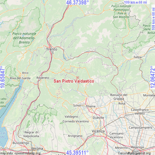
| Upper-left | 46.37398°, | 10.65847° |
| Center: | 45.8867°, | 11.36159° |
| Lower-right: | 45.39511°, | 12.06472° |
| Map W x H: | 108.8×108.8 km | = 67.6×67.6mi |
| max Lat: | 47.04031° ⇑11.2% North |
| San Pietro Valdastico: | 45.8867° |
| min Lat: | ⇓88.8% South 35.50142° |
| min Long | San Pietro Vald | max Long |
| 6.69888° | 11.36159° | 18.48682° |
| W 47.6%⇐ | ⇒52.4% E |
Elevation
Elevation of San Pietro Valdastico is 396 m = 1299 ft, and this is 89.3 m = 293 ft above average elevation for this country.
| Max E: |
2085 m = 6841 ft | 29.8% |
| San Pietro Valdastico | 396 m 1299 ft | |
| Avg. | 306.7 m = 1006 ft | |
Min E: |
-4 m = -13 ft | 70.2% |
See also: Italy elevation on elevation.city.
Geographical zone
San Pietro Valdastico is located in North temperate zone (between Tropic of Cancer and the Arctic Circle). Distance of this North polar circle is 2299.1 km =1428.6 mi to North.| Distance of | km | miles | from San Pietro Valdastico |
|---|---|---|---|
| North Pole | 4904.9 | 3047.8 | to North |
| Arctic Circle | 2299.1 | 1428.6 | to North |
| Tropic Cancer | 2496.2 | 1551.1 | to South |
| Equator | 5102.1 | 3170.3 | to South |


Nearby cities:
15 places around San Pietro Valdastico: (largest is in red/bold)
• Arsiero
9.2 km =5.7 mi,  182°
182°
• Canove di Roana
9 km =5.6 mi,  106°
106°
• Cesuna
9.1 km =5.7 mi,  126°
126°
• Gionghi-Cappella
8.7 km =5.4 mi,  309°
309°
• Laghi
9.8 km =6.1 mi,  224°
224°
• Lastebasse
7.5 km =4.7 mi,  294°
294°
• Longhi
4.5 km =2.8 mi,  300°
300°
• Luserna
5 km =3.1 mi,  323°
323°
• Pedemonte
4.8 km =3 mi, 300°
• Roana
7.1 km =4.4 mi,  98°
98°
• Rotzo
3.8 km =2.4 mi,  135°
135°
• Seghe
9.8 km =6.1 mi, 175°
• Tonezza del Cimone
3.3 km =2.1 mi,  201°
201°
• Treschè Conca
7.4 km =4.6 mi, 135°
• Velo
10.8 km =6.7 mi, 177°
Sources, notices
• [Note1] Compared only with cities in Italy existing in our database
• [Src1] Map data: © OpenStreetMap contributors (CC-BY-SA)
• [Src2] Other city data from geonames.org with taken over terms of usage.
• [Src3] Geographical zone / Annual Mean Temperature by Robert A. Rohde @ Wikipedia
