Lugagnano Val d'Arda geodata
Lugagnano Val d'Arda (Emilia-Romagna) is a seat of a third-order administrative division; located in Italy in Europe/Rome (GMT+2) time zone. With population of 2,994 people, there are 3048 cities with bigger population in this country. Compared to other cities in Italy, 56.6% of cities are located further ↓South; 69.6% of cities are located further →East and 50.6% of cities have higher elevation than Lugagnano Val d'Arda. Note1
Administrative division(s):
- Level 1: Emilia-Romagna
- Level 2: Provincia di Piacenza
- Level 3: Lugagnano Val d'Arda


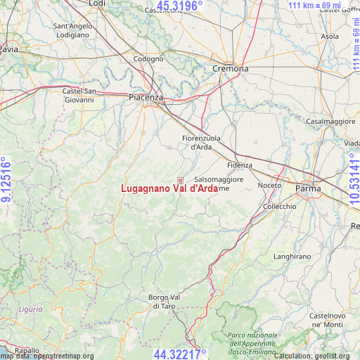
Lugagnano Val d'Arda GPS coordinates[2]
44° 49' 22.944" North, 9° 49' 41.808" East
| Map corner | latitude | longitude |
|---|---|---|
| Upper-left | 45.3196°, | 9.12516° |
| Center: | 44.82304°, | 9.82828° |
| Lower-right: | 44.32217°, | 10.53141° |
| Map W x H: | 110.9×110.9 km | = 68.9×68.9mi |
| max Lat: | 47.04031° ⇑43.4% North |
| Lugagnano Val d'Arda: | 44.82304° |
| min Lat: | ⇓56.6% South 35.50142° |
| min Long | Lugagnano Val d | max Long |
| 6.69888° | 9.82828° | 18.48682° |
| W 30.4%⇐ | ⇒69.6% E |
Elevation
Elevation of Lugagnano Val d'Arda is 231 m = 758 ft, and this is 75.7 m = 248 ft below average elevation for this country.
| Max E: |
2085 m = 6841 ft | 50.6% |
| Avg. | 306.7 m = 1006 ft | |
| Lugagnano Val d'Arda | 231 m = 758 ft | |
Min E: |
-4 m = -13 ft | 49.4% |
See also: Italy elevation on elevation.city.
Geographical zone
Lugagnano Val d'Arda is located in North temperate zone (between Tropic of Cancer and the Arctic Circle). Distance of this Northern Tropic circle is 2377.9 km =1477.6 mi to South.| Distance of | km | miles | from Lugagnano Val d'Arda |
|---|---|---|---|
| North Pole | 5023.2 | 3121.3 | to North |
| Arctic Circle | 2417.3 | 1502 | to North |
| Tropic Cancer | 2377.9 | 1477.6 | to South |
| Equator | 4983.9 | 3096.9 | to South |


Nearby cities:
15 places around Lugagnano Val d'Arda: (largest is in red/bold)
• Alseno
13.5 km =8.4 mi,  52°
52°
• Bagni di Tabiano
15.3 km =9.5 mi,  96°
96°
• Bore
12 km =7.5 mi,  193°
193°
• Carpaneto Piacentino
10.6 km =6.6 mi,  342°
342°
• Castell'Arquato
5 km =3.1 mi, 45°
• Castelnuovo Fogliani
12.8 km =8 mi,  62°
62°
• Fiorenzuola d'Arda
13.1 km =8.1 mi,  30°
30°
• Gropparello
8 km =5 mi,  278°
278°
• Lusurasco
9.7 km =6 mi,  41°
41°
• Morfasso
14.9 km =9.3 mi,  221°
221°
• Pellegrino Parmense
13.3 km =8.3 mi,  141°
141°
• Ponte dell'Olio
15.3 km =9.5 mi,  288°
288°
• Salsomaggiore Terme
12.5 km =7.8 mi,  93°
93°
• Vernasca
2.7 km =1.7 mi,  176°
176°
• Vigolo Marchese
6.4 km =4 mi,  11°
11°
Sources, notices
• [Note1] Compared only with cities in Italy existing in our database
• [Src1] Map data: © OpenStreetMap contributors (CC-BY-SA)
• [Src2] Other city data from geonames.org with taken over terms of usage.
• [Src3] Geographical zone / Annual Mean Temperature by Robert A. Rohde @ Wikipedia
