Gropparello geodata
Gropparello (Emilia-Romagna) is a seat of a third-order administrative division; located in Italy in Europe/Rome (GMT+2) time zone. With population of 769 people, there are 7822 cities with bigger population in this country. Compared to other cities in Italy, 56.8% of cities are located further ↓South; 70.5% of cities are located further →East and 70.2% of cities have lower elevation than Gropparello. Note1
Administrative division(s):
- Level 1: Emilia-Romagna
- Level 2: Provincia di Piacenza
- Level 3: Gropparello


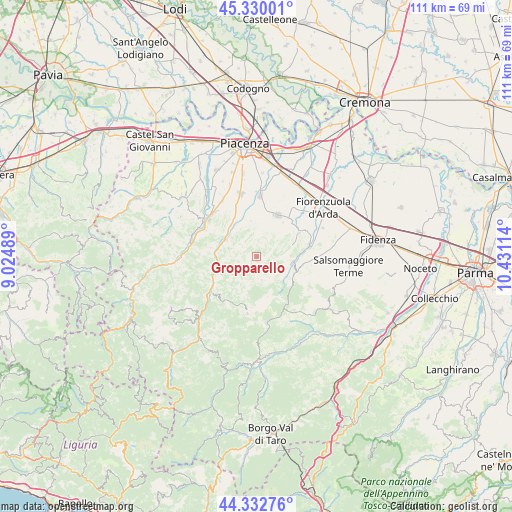
Gropparello GPS coordinates[2]
44° 50' 0.744" North, 9° 43' 40.836" East
| Map corner | latitude | longitude |
|---|---|---|
| Upper-left | 45.33001°, | 9.02489° |
| Center: | 44.83354°, | 9.72801° |
| Lower-right: | 44.33276°, | 10.43114° |
| Map W x H: | 110.9×110.9 km | = 68.9×68.9mi |
| max Lat: | 47.04031° ⇑43.2% North |
| Gropparello: | 44.83354° |
| min Lat: | ⇓56.8% South 35.50142° |
| min Long | Gropparello | max Long |
| 6.69888° | 9.72801° | 18.48682° |
| W 29.5%⇐ | ⇒70.5% E |
Elevation
Elevation of Gropparello is 396 m = 1299 ft, and this is 89.3 m = 293 ft above average elevation for this country.
| Max E: |
2085 m = 6841 ft | 29.8% |
| Gropparello | 396 m 1299 ft | |
| Avg. | 306.7 m = 1006 ft | |
Min E: |
-4 m = -13 ft | 70.2% |
See also: Italy elevation on elevation.city.
Geographical zone
Gropparello is located in North temperate zone (between Tropic of Cancer and the Arctic Circle). Distance of this Northern Tropic circle is 2379.1 km =1478.3 mi to South.| Distance of | km | miles | from Gropparello |
|---|---|---|---|
| North Pole | 5022 | 3120.5 | to North |
| Arctic Circle | 2416.2 | 1501.4 | to North |
| Tropic Cancer | 2379.1 | 1478.3 | to South |
| Equator | 4985 | 3097.5 | to South |


Nearby cities:
15 places around Gropparello: (largest is in red/bold)
• Bettola
11.3 km =7 mi,  236°
236°
• Bore
13.7 km =8.5 mi,  158°
158°
• Carpaneto Piacentino
10 km =6.2 mi,  27°
27°
• Castell'Arquato
11.7 km =7.3 mi,  78°
78°
• Lugagnano Val d'Arda
8 km =5 mi,  98°
98°
• Morfasso
12.5 km =7.8 mi,  189°
189°
• Niviano
14.2 km =8.8 mi,  326°
326°
• Podenzano
13.9 km =8.6 mi,  345°
345°
• Ponte dell'Olio
7.6 km =4.7 mi,  299°
299°
• Rivergaro
13.3 km =8.3 mi,  312°
312°
• San Giorgio Piacentino
13.2 km =8.2 mi,  3°
3°
• San Giovanni-San Bernardino
10.4 km =6.5 mi, 244°
• Vernasca
9 km =5.6 mi,  115°
115°
• Vigolo Marchese
10.5 km =6.5 mi,  60°
60°
• Vigolzone
10.1 km =6.3 mi, 332°
Sources, notices
• [Note1] Compared only with cities in Italy existing in our database
• [Src1] Map data: © OpenStreetMap contributors (CC-BY-SA)
• [Src2] Other city data from geonames.org with taken over terms of usage.
• [Src3] Geographical zone / Annual Mean Temperature by Robert A. Rohde @ Wikipedia
