Salsomaggiore Terme geodata
Salsomaggiore Terme (Emilia-Romagna) is a seat of a third-order administrative division; located in Italy in Europe/Rome (GMT+2) time zone. With population of 15,754 people, there are 580 cities with bigger population in this country. Compared to other cities in Italy, 56.5% of cities are located further ↓South; 68% of cities are located further →East and 61.5% of cities have higher elevation than Salsomaggiore Terme. Note1
Administrative division(s):
- Level 1: Emilia-Romagna
- Level 2: Provincia di Parma
- Level 3: Salsomaggiore Terme


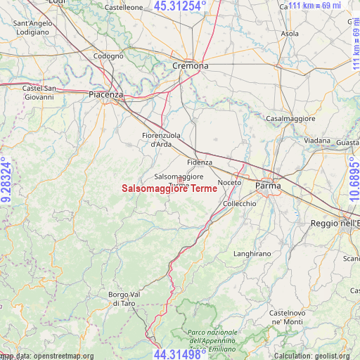
Salsomaggiore Terme GPS coordinates[2]
44° 48' 57.312" North, 9° 59' 10.932" East
| Map corner | latitude | longitude |
|---|---|---|
| Upper-left | 45.31254°, | 9.28324° |
| Center: | 44.81592°, | 9.98637° |
| Lower-right: | 44.31498°, | 10.6895° |
| Map W x H: | 110.9×110.9 km | = 68.9×68.9mi |
| max Lat: | 47.04031° ⇑43.5% North |
| Salsomaggiore Terme: | 44.81592° |
| min Lat: | ⇓56.5% South 35.50142° |
| min Long | Salsomaggiore T | max Long |
| 6.69888° | 9.98637° | 18.48682° |
| W 32%⇐ | ⇒68% E |
Elevation
Elevation of Salsomaggiore Terme is 152 m = 499 ft, and this is 154.7 m = 508 ft below average elevation for this country.
| Max E: |
2085 m = 6841 ft | 61.5% |
| Avg. | 306.7 m = 1006 ft | |
| Salsomaggiore Terme | 152 m = 499 ft | |
Min E: |
-4 m = -13 ft | 38.5% |
See also: Italy elevation on elevation.city.
Geographical zone
Salsomaggiore Terme is located in North temperate zone (between Tropic of Cancer and the Arctic Circle). Distance of this Northern Tropic circle is 2377.1 km =1477.1 mi to South.| Distance of | km | miles | from Salsomaggiore Terme |
|---|---|---|---|
| North Pole | 5024 | 3121.8 | to North |
| Arctic Circle | 2418.1 | 1502.5 | to North |
| Tropic Cancer | 2377.1 | 1477.1 | to South |
| Equator | 4983.1 | 3096.4 | to South |


Nearby cities:
15 places around Salsomaggiore Terme: (largest is in red/bold)
• Alseno
9.2 km =5.7 mi,  349°
349°
• Bagni di Tabiano
2.9 km =1.8 mi,  108°
108°
• Castell'Arquato
9.9 km =6.2 mi,  295°
295°
• Castelnuovo Fogliani
6.8 km =4.2 mi, 351°
• Felegara
14.5 km =9 mi,  136°
136°
• Fidenza
8.1 km =5 mi,  45°
45°
• Fiorenzuola d'Arda
13.4 km =8.3 mi,  334°
334°
• Lugagnano Val d'Arda
12.5 km =7.8 mi,  273°
273°
• Lusurasco
10.1 km =6.3 mi,  323°
323°
• Medesano
13.6 km =8.5 mi,  118°
118°
• Pellegrino Parmense
10.5 km =6.5 mi,  203°
203°
• Sant'Andrea Bagni
13.1 km =8.1 mi, 142°
• Varano De' Melegari
14.4 km =8.9 mi,  172°
172°
• Vernasca
12.4 km =7.7 mi,  261°
261°
• Vigolo Marchese
13.2 km =8.2 mi, 302°
Sources, notices
• [Note1] Compared only with cities in Italy existing in our database
• [Src1] Map data: © OpenStreetMap contributors (CC-BY-SA)
• [Src2] Other city data from geonames.org with taken over terms of usage.
• [Src3] Geographical zone / Annual Mean Temperature by Robert A. Rohde @ Wikipedia
