Lonigo geodata
Lonigo (Veneto) is a seat of a third-order administrative division; located in Italy in Europe/Rome (GMT+2) time zone. With population of 12,110 people, there are 766 cities with bigger population in this country. Compared to other cities in Italy, 69.8% of cities are located further ↓South; 52.1% of cities are located further →East and 87% of cities have higher elevation than Lonigo. Note1


Lonigo GPS coordinates[2]
45° 23' 8.736" North, 11° 23' 2.472" East
| Map corner | latitude | longitude |
|---|---|---|
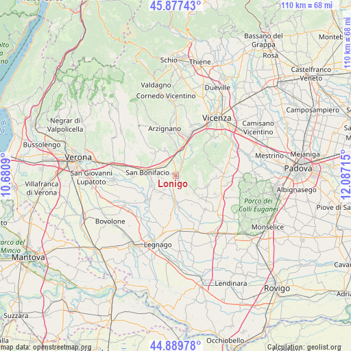
| Upper-left | 45.87743°, | 10.6809° |
| Center: | 45.38576°, | 11.38402° |
| Lower-right: | 44.88978°, | 12.08715° |
| Map W x H: | 109.8×109.8 km | = 68.2×68.2mi |
| max Lat: | 47.04031° ⇑30.2% North |
| Lonigo: | 45.38576° |
| min Lat: | ⇓69.8% South 35.50142° |
| min Long | Lonigo | max Long |
| 6.69888° | 11.38402° | 18.48682° |
| W 47.9%⇐ | ⇒52.1% E |
Elevation
Elevation of Lonigo is 25 m = 82 ft, and this is 281.7 m = 924 ft below average elevation for this country.
| Max E: |
2085 m = 6841 ft | 87% |
| Avg. | 306.7 m = 1006 ft | |
| Lonigo | 25 m = 82 ft | |
Min E: |
-4 m = -13 ft | 13% |
See also: Italy elevation on elevation.city.
Geographical zone
Lonigo is located in North temperate zone (between Tropic of Cancer and the Arctic Circle). Distance of this North polar circle is 2354.8 km =1463.2 mi to North.| Distance of | km | miles | from Lonigo |
|---|---|---|---|
| North Pole | 4960.6 | 3082.4 | to North |
| Arctic Circle | 2354.8 | 1463.2 | to North |
| Tropic Cancer | 2440.5 | 1516.5 | to South |
| Equator | 5046.4 | 3135.7 | to South |


Nearby cities:
15 places around Lonigo: (largest is in red/bold)
• Alonte
4 km =2.5 mi,  123°
123°
• Arcole
8 km =5 mi,  250°
250°
• Bagnolo
3.2 km =2 mi,  193°
193°
• Gazzolo-Volpino
5.7 km =3.5 mi,  258°
258°
• Grancona
6.6 km =4.1 mi,  52°
52°
• Locara
5 km =3.1 mi,  306°
306°
• Meledo
6.3 km =3.9 mi,  22°
22°
• Montebello Vicentino
8.2 km =5.1 mi,  359°
359°
• Monticello di Fara
4.8 km =3 mi,  5°
5°
• Pederiva
7.6 km =4.7 mi,  57°
57°
• San Germano dei Berici
7 km =4.3 mi,  75°
75°
• San Gregorio
8.2 km =5.1 mi,  234°
234°
• Santo Stefano-Bonaldo
4.6 km =2.9 mi,  243°
243°
• Sarego
2.8 km =1.7 mi,  29°
29°
• Zimella
6.1 km =3.8 mi, 185°
Sources, notices
• [Note1] Compared only with cities in Italy existing in our database
• [Src1] Map data: © OpenStreetMap contributors (CC-BY-SA)
• [Src2] Other city data from geonames.org with taken over terms of usage.
• [Src3] Geographical zone / Annual Mean Temperature by Robert A. Rohde @ Wikipedia
