Isorella geodata
Isorella (Lombardy) is a seat of a third-order administrative division; located in Italy in Europe/Rome (GMT+2) time zone. With population of 3,561 people, there are 2639 cities with bigger population in this country. Compared to other cities in Italy, 67.7% of cities are located further ↓South; 64.8% of cities are located further →East and 78.8% of cities have higher elevation than Isorella. Note1


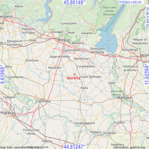
Isorella GPS coordinates[2]
45° 18' 32.832" North, 10° 19' 22.116" East
| Map corner | latitude | longitude |
|---|---|---|
| Upper-left | 45.80146°, | 9.61968° |
| Center: | 45.30912°, | 10.32281° |
| Lower-right: | 44.81247°, | 11.02594° |
| Map W x H: | 110×110 km | = 68.4×68.4mi |
| max Lat: | 47.04031° ⇑32.3% North |
| Isorella: | 45.30912° |
| min Lat: | ⇓67.7% South 35.50142° |
| min Long | Isorella | max Long |
| 6.69888° | 10.32281° | 18.48682° |
| W 35.2%⇐ | ⇒64.8% E |
Elevation
Elevation of Isorella is 55 m = 180 ft, and this is 251.7 m = 826 ft below average elevation for this country.
| Max E: |
2085 m = 6841 ft | 78.8% |
| Avg. | 306.7 m = 1006 ft | |
| Isorella | 55 m = 180 ft | |
Min E: |
-4 m = -13 ft | 21.2% |
See also: Italy elevation on elevation.city.
Geographical zone
Isorella is located in North temperate zone (between Tropic of Cancer and the Arctic Circle). Distance of this North polar circle is 2363.3 km =1468.5 mi to North.| Distance of | km | miles | from Isorella |
|---|---|---|---|
| North Pole | 4969.2 | 3087.7 | to North |
| Arctic Circle | 2363.3 | 1468.5 | to North |
| Tropic Cancer | 2432 | 1511.2 | to South |
| Equator | 5037.9 | 3130.4 | to South |


Nearby cities:
15 places around Isorella: (largest is in red/bold)
• Acquafredda
7.1 km =4.4 mi,  91°
91°
• Calvisano
4.3 km =2.7 mi,  21°
21°
• Casalmoro
8.7 km =5.4 mi,  127°
127°
• Castelletto
7.4 km =4.6 mi,  289°
289°
• Fiesse
8.6 km =5.3 mi,  179°
179°
• Gambara
6.6 km =4.1 mi,  199°
199°
• Gottolengo
4.6 km =2.9 mi,  246°
246°
• Mezzane
7.2 km =4.5 mi,  53°
53°
• Pavone del Mella
8.9 km =5.5 mi,  264°
264°
• Pralboino
9.4 km =5.8 mi,  240°
240°
• Remedello
5.1 km =3.2 mi, 131°
• Remedello di Sopra
5.1 km =3.2 mi, 131°
• Remedello di Sotto
7.1 km =4.4 mi,  140°
140°
• Viadana
7.1 km =4.4 mi,  8°
8°
• Visano
3.9 km =2.4 mi,  77°
77°
Sources, notices
• [Note1] Compared only with cities in Italy existing in our database
• [Src1] Map data: © OpenStreetMap contributors (CC-BY-SA)
• [Src2] Other city data from geonames.org with taken over terms of usage.
• [Src3] Geographical zone / Annual Mean Temperature by Robert A. Rohde @ Wikipedia
