Illasi geodata
Illasi (Veneto) is a seat of a third-order administrative division; located in Italy in Europe/Rome (GMT+2) time zone. With population of 3,029 people, there are 3016 cities with bigger population in this country. Compared to other cities in Italy, 72.4% of cities are located further ↓South; 54.7% of cities are located further →East and 60% of cities have higher elevation than Illasi. Note1


Illasi GPS coordinates[2]
45° 27' 59.868" North, 11° 10' 53.94" East
| Map corner | latitude | longitude |
|---|---|---|
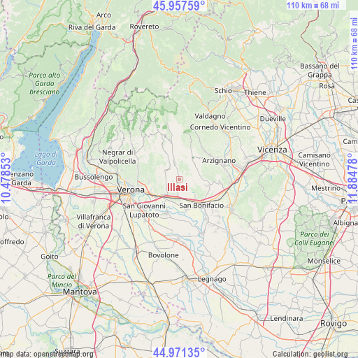
| Upper-left | 45.95759°, | 10.47853° |
| Center: | 45.46663°, | 11.18165° |
| Lower-right: | 44.97135°, | 11.88478° |
| Map W x H: | 109.7×109.7 km | = 68.2×68.2mi |
| max Lat: | 47.04031° ⇑27.6% North |
| Illasi: | 45.46663° |
| min Lat: | ⇓72.4% South 35.50142° |
| min Long | Illasi | max Long |
| 6.69888° | 11.18165° | 18.48682° |
| W 45.3%⇐ | ⇒54.7% E |
Elevation
Elevation of Illasi is 163 m = 535 ft, and this is 143.7 m = 471 ft below average elevation for this country.
| Max E: |
2085 m = 6841 ft | 60% |
| Avg. | 306.7 m = 1006 ft | |
| Illasi | 163 m = 535 ft | |
Min E: |
-4 m = -13 ft | 40% |
See also: Italy elevation on elevation.city.
Geographical zone
Illasi is located in North temperate zone (between Tropic of Cancer and the Arctic Circle). Distance of this North polar circle is 2345.8 km =1457.6 mi to North.| Distance of | km | miles | from Illasi |
|---|---|---|---|
| North Pole | 4951.6 | 3076.8 | to North |
| Arctic Circle | 2345.8 | 1457.6 | to North |
| Tropic Cancer | 2449.5 | 1522 | to South |
| Equator | 5055.4 | 3141.3 | to South |


Nearby cities:
15 places around Illasi: (largest is in red/bold)
• Caldierino-Rota
5.9 km =3.7 mi,  198°
198°
• Caldiero
5.8 km =3.6 mi,  183°
183°
• Cazzano di Tramigna
1.8 km =1.1 mi,  66°
66°
• Cellore
2.2 km =1.4 mi,  353°
353°
• Colognola ai Colli
3.7 km =2.3 mi, 176°
• Lavagno
4.8 km =3 mi,  230°
230°
• Marcellise
5.9 km =3.7 mi,  264°
264°
• Mezzane di Sotto
4.6 km =2.9 mi,  291°
291°
• Montecchia di Crosara
5.9 km =3.7 mi, 73°
• Monticelli-Fontana
5.4 km =3.4 mi,  220°
220°
• San Briccio
5 km =3.1 mi,  254°
254°
• San Pietro
4.9 km =3 mi,  236°
236°
• San Vittore
5.2 km =3.2 mi,  142°
142°
• Strà-Montanara-Pieve
5.1 km =3.2 mi, 201°
• Tregnago
5.4 km =3.4 mi, 345°
Sources, notices
• [Note1] Compared only with cities in Italy existing in our database
• [Src1] Map data: © OpenStreetMap contributors (CC-BY-SA)
• [Src2] Other city data from geonames.org with taken over terms of usage.
• [Src3] Geographical zone / Annual Mean Temperature by Robert A. Rohde @ Wikipedia
