Grontardo geodata
Grontardo (Lombardy) is a seat of a third-order administrative division; located in Italy in Europe/Rome (GMT+2) time zone. With population of 929 people, there are 6988 cities with bigger population in this country. Compared to other cities in Italy, 65.1% of cities are located further ↓South; 66.4% of cities are located further →East and 80.9% of cities have higher elevation than Grontardo. Note1


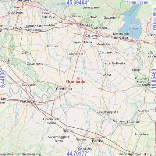
Grontardo GPS coordinates[2]
45° 12' 4.896" North, 10° 9' 5.4" East
| Map corner | latitude | longitude |
|---|---|---|
| Upper-left | 45.69464°, | 9.44838° |
| Center: | 45.20136°, | 10.1515° |
| Lower-right: | 44.70377°, | 10.85463° |
| Map W x H: | 110.2×110.2 km | = 68.5×68.5mi |
| max Lat: | 47.04031° ⇑34.9% North |
| Grontardo: | 45.20136° |
| min Lat: | ⇓65.1% South 35.50142° |
| min Long | Grontardo | max Long |
| 6.69888° | 10.1515° | 18.48682° |
| W 33.6%⇐ | ⇒66.4% E |
Elevation
Elevation of Grontardo is 46 m = 151 ft, and this is 260.7 m = 855 ft below average elevation for this country.
| Max E: |
2085 m = 6841 ft | 80.9% |
| Avg. | 306.7 m = 1006 ft | |
| Grontardo | 46 m = 151 ft | |
Min E: |
-4 m = -13 ft | 19.1% |
See also: Italy elevation on elevation.city.
Geographical zone
Grontardo is located in North temperate zone (between Tropic of Cancer and the Arctic Circle). Distance of this North polar circle is 2375.3 km =1475.9 mi to North.| Distance of | km | miles | from Grontardo |
|---|---|---|---|
| North Pole | 4981.1 | 3095.1 | to North |
| Arctic Circle | 2375.3 | 1475.9 | to North |
| Tropic Cancer | 2420 | 1503.7 | to South |
| Equator | 5025.9 | 3122.9 | to South |


Nearby cities:
15 places around Grontardo: (largest is in red/bold)
• Alfianello
7.3 km =4.5 mi,  357°
357°
• Ardole San Marino
6.2 km =3.9 mi,  215°
215°
• Cappella de' Picenardi
7.8 km =4.8 mi,  127°
127°
• Cicognolo
5 km =3.1 mi,  138°
138°
• Corte de' Frati
4.3 km =2.7 mi,  296°
296°
• Dosimo
4.2 km =2.6 mi,  243°
243°
• Gabbioneta
5.6 km =3.5 mi,  72°
72°
• Gadesco-Pieve Delmona
5.6 km =3.5 mi,  210°
210°
• Persico Dosimo
4 km =2.5 mi, 244°
• Pescarolo
2.9 km =1.8 mi,  106°
106°
• Pessina Cremonese
7.8 km =4.8 mi,  103°
103°
• Pozzaglio
7.7 km =4.8 mi,  268°
268°
• Scandolara Ripa d'Oglio
2.3 km =1.4 mi,  11°
11°
• Seniga
5.2 km =3.2 mi,  22°
22°
• Vescovato
3.2 km =2 mi,  161°
161°
Sources, notices
• [Note1] Compared only with cities in Italy existing in our database
• [Src1] Map data: © OpenStreetMap contributors (CC-BY-SA)
• [Src2] Other city data from geonames.org with taken over terms of usage.
• [Src3] Geographical zone / Annual Mean Temperature by Robert A. Rohde @ Wikipedia
