Seniga geodata
Seniga (Lombardy) is a seat of a third-order administrative division; located in Italy in Europe/Rome (GMT+2) time zone. With population of 1,234 people, there are 5847 cities with bigger population in this country. Compared to other cities in Italy, 66.1% of cities are located further ↓South; 66.1% of cities are located further →East and 80.9% of cities have higher elevation than Seniga. Note1


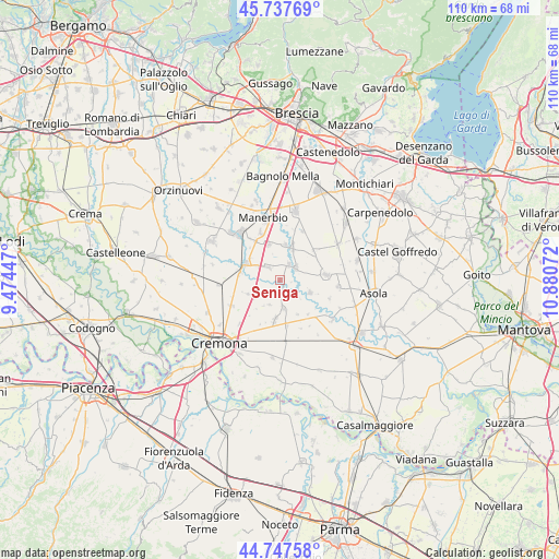
Seniga GPS coordinates[2]
45° 14' 41.244" North, 10° 10' 39.324" East
| Map corner | latitude | longitude |
|---|---|---|
| Upper-left | 45.73769°, | 9.47447° |
| Center: | 45.24479°, | 10.17759° |
| Lower-right: | 44.74758°, | 10.88072° |
| Map W x H: | 110.1×110.1 km | = 68.4×68.4mi |
| max Lat: | 47.04031° ⇑33.9% North |
| Seniga: | 45.24479° |
| min Lat: | ⇓66.1% South 35.50142° |
| min Long | Seniga | max Long |
| 6.69888° | 10.17759° | 18.48682° |
| W 33.9%⇐ | ⇒66.1% E |
Elevation
Elevation of Seniga is 46 m = 151 ft, and this is 260.7 m = 855 ft below average elevation for this country.
| Max E: |
2085 m = 6841 ft | 80.9% |
| Avg. | 306.7 m = 1006 ft | |
| Seniga | 46 m = 151 ft | |
Min E: |
-4 m = -13 ft | 19.1% |
See also: Italy elevation on elevation.city.
Geographical zone
Seniga is located in North temperate zone (between Tropic of Cancer and the Arctic Circle). Distance of this North polar circle is 2370.4 km =1472.9 mi to North.| Distance of | km | miles | from Seniga |
|---|---|---|---|
| North Pole | 4976.3 | 3092.1 | to North |
| Arctic Circle | 2370.4 | 1472.9 | to North |
| Tropic Cancer | 2424.8 | 1506.7 | to South |
| Equator | 5030.7 | 3125.9 | to South |


Nearby cities:
15 places around Seniga: (largest is in red/bold)
• Alfianello
3.4 km =2.1 mi,  316°
316°
• Cigole
7 km =4.3 mi,  7°
7°
• Corte de' Frati
6.6 km =4.1 mi,  243°
243°
• Gabbioneta
4.6 km =2.9 mi,  133°
133°
• Grontardo
5.2 km =3.2 mi,  202°
202°
• Milzano
3.6 km =2.2 mi,  27°
27°
• Ostiano
6.5 km =4 mi,  112°
112°
• Pavone del Mella
6.8 km =4.2 mi,  21°
21°
• Pescarolo
5.7 km =3.5 mi,  172°
172°
• Pontevico
7.4 km =4.6 mi,  295°
295°
• Pralboino
4.1 km =2.5 mi,  52°
52°
• Robecco d'Oglio
8 km =5 mi,  280°
280°
• San Gervasio Bresciano
7.4 km =4.6 mi,  340°
340°
• Scandolara Ripa d'Oglio
3 km =1.9 mi,  211°
211°
• Vescovato
7.9 km =4.9 mi,  187°
187°
Sources, notices
• [Note1] Compared only with cities in Italy existing in our database
• [Src1] Map data: © OpenStreetMap contributors (CC-BY-SA)
• [Src2] Other city data from geonames.org with taken over terms of usage.
• [Src3] Geographical zone / Annual Mean Temperature by Robert A. Rohde @ Wikipedia
