Gerosa geodata
Gerosa (Lombardy) is a seat of a third-order administrative division; located in Italy in Europe/Rome (GMT+2) time zone. With population of 254 people, there are 10875 cities with bigger population in this country. Compared to other cities in Italy, 87.7% of cities are located further ↓South; 72.4% of cities are located further →East and 91.8% of cities have lower elevation than Gerosa. Note1


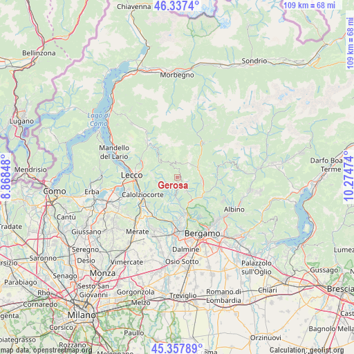
Gerosa GPS coordinates[2]
45° 50' 59.28" North, 9° 34' 17.796" East
| Map corner | latitude | longitude |
|---|---|---|
| Upper-left | 46.3374°, | 8.86848° |
| Center: | 45.8498°, | 9.57161° |
| Lower-right: | 45.35789°, | 10.27474° |
| Map W x H: | 108.9×108.9 km | = 67.7×67.7mi |
| max Lat: | 47.04031° ⇑12.3% North |
| Gerosa: | 45.8498° |
| min Lat: | ⇓87.7% South 35.50142° |
| min Long | Gerosa | max Long |
| 6.69888° | 9.57161° | 18.48682° |
| W 27.6%⇐ | ⇒72.4% E |
Elevation
Elevation of Gerosa is 765 m = 2510 ft, and this is 458.3 m = 1504 ft above average elevation for this country.
| Max E: |
2085 m = 6841 ft | 8.2% |
| Gerosa | 765 m 2510 ft | |
| Avg. | 306.7 m = 1006 ft | |
Min E: |
-4 m = -13 ft | 91.8% |
See also: Italy elevation on elevation.city.
Geographical zone
Gerosa is located in North temperate zone (between Tropic of Cancer and the Arctic Circle). Distance of this North polar circle is 2303.2 km =1431.1 mi to North.| Distance of | km | miles | from Gerosa |
|---|---|---|---|
| North Pole | 4909 | 3050.3 | to North |
| Arctic Circle | 2303.2 | 1431.1 | to North |
| Tropic Cancer | 2492.1 | 1548.5 | to South |
| Equator | 5098 | 3167.7 | to South |


Nearby cities:
15 places around Gerosa: (largest is in red/bold)
• Berbenno
3.9 km =2.4 mi,  180°
180°
• Blello
1.3 km =0.8 mi, 181°
• Botta
3.6 km =2.2 mi,  237°
237°
• Brembilla
3.7 km =2.3 mi,  148°
148°
• Brumano
5.5 km =3.4 mi,  275°
275°
• Calchera-Frontale
5 km =3.1 mi,  249°
249°
• Corna Imagna
3 km =1.9 mi,  224°
224°
• Fuipiano Valle Imagna
3.4 km =2.1 mi, 278°
• Laxolo
5.1 km =3.2 mi, 154°
• Locatello
3.3 km =2.1 mi, 240°
• Rota d'Imagna
5.1 km =3.2 mi, 245°
• Sant'Omobono Terme
5.4 km =3.4 mi,  210°
210°
• Selino Basso
5.2 km =3.2 mi, 212°
• Taleggio
4.9 km =3 mi,  353°
353°
• Vedeseta
5.2 km =3.2 mi,  331°
331°
Sources, notices
• [Note1] Compared only with cities in Italy existing in our database
• [Src1] Map data: © OpenStreetMap contributors (CC-BY-SA)
• [Src2] Other city data from geonames.org with taken over terms of usage.
• [Src3] Geographical zone / Annual Mean Temperature by Robert A. Rohde @ Wikipedia
