Gais geodata
Gais (Trentino-Alto Adige) is a seat of a third-order administrative division; located in Italy in Europe/Rome (GMT+2) time zone. With population of 1,764 people, there are 4548 cities with bigger population in this country. Compared to other cities in Italy, 99.8% of cities are located further ↓South; 55.2% of cities are located further ←West and 94% of cities have lower elevation than Gais. Note1


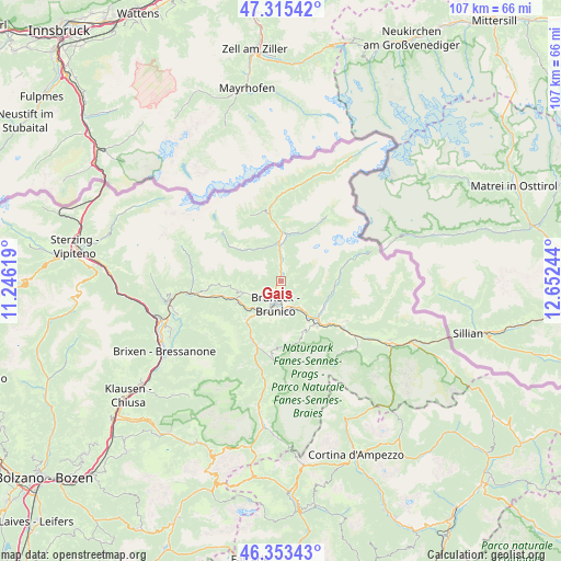
Gais GPS coordinates[2]
46° 50' 11.688" North, 11° 56' 57.516" East
| Map corner | latitude | longitude |
|---|---|---|
| Upper-left | 47.31542°, | 11.24619° |
| Center: | 46.83658°, | 11.94931° |
| Lower-right: | 46.35343°, | 12.65244° |
| Map W x H: | 107×107 km | = 66.5×66.5mi |
| max Lat: | 47.04031° ⇑0.2% North |
| Gais: | 46.83658° |
| min Lat: | ⇓99.8% South 35.50142° |
| min Long | Gais | max Long |
| 6.69888° | 11.94931° | 18.48682° |
| W 55.2%⇐ | ⇒44.8% E |
Elevation
Elevation of Gais is 837 m = 2746 ft, and this is 530.3 m = 1740 ft above average elevation for this country.
| Max E: |
2085 m = 6841 ft | 6% |
| Gais | 837 m 2746 ft | |
| Avg. | 306.7 m = 1006 ft | |
Min E: |
-4 m = -13 ft | 94% |
See also: Italy elevation on elevation.city.
Geographical zone
Gais is located in North temperate zone (between Tropic of Cancer and the Arctic Circle). Distance of this North polar circle is 2193.4 km =1362.9 mi to North.| Distance of | km | miles | from Gais |
|---|---|---|---|
| North Pole | 4799.3 | 2982.1 | to North |
| Arctic Circle | 2193.4 | 1362.9 | to North |
| Tropic Cancer | 2601.8 | 1616.7 | to South |
| Equator | 5207.7 | 3235.9 | to South |


Nearby cities:
15 places around Gais: (largest is in red/bold)
• Brunico
4.3 km =2.7 mi,  195°
195°
• Campo Tures
8 km =5 mi,  6°
6°
• Casteldarne
9.3 km =5.8 mi,  242°
242°
• Chienes
9 km =5.6 mi,  248°
248°
• Falzes
5.7 km =3.5 mi, 243°
• Mühlen in Taufers
7 km =4.3 mi,  356°
356°
• Perca
5.5 km =3.4 mi,  151°
151°
• Rasun di Sopra
9.7 km =6 mi,  122°
122°
• Riscone
6.6 km =4.1 mi,  178°
178°
• San Lorenzo di Sebato
6.5 km =4 mi,  208°
208°
• San Martino
7.7 km =4.8 mi, 210°
• Selva dei Molini
9.1 km =5.7 mi,  310°
310°
• Teodone
3.7 km =2.3 mi, 176°
• Uttenheim
3.2 km =2 mi, 357°
• Valdaora di Sotto
9.2 km =5.7 mi, 145°
Sources, notices
• [Note1] Compared only with cities in Italy existing in our database
• [Src1] Map data: © OpenStreetMap contributors (CC-BY-SA)
• [Src2] Other city data from geonames.org with taken over terms of usage.
• [Src3] Geographical zone / Annual Mean Temperature by Robert A. Rohde @ Wikipedia
