Brunico geodata
Brunico (Trentino-Alto Adige) is a seat of a third-order administrative division; located in Italy in Europe/Rome (GMT+2) time zone. With population of 12,282 people, there are 756 cities with bigger population in this country. Compared to other cities in Italy, 99.7% of cities are located further ↓South; 55% of cities are located further ←West and 93.8% of cities have lower elevation than Brunico. Note1


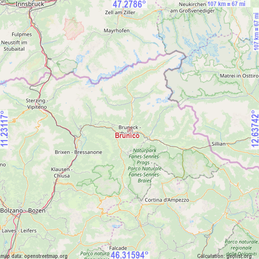
Brunico GPS coordinates[2]
46° 47' 57.912" North, 11° 56' 3.444" East
| Map corner | latitude | longitude |
|---|---|---|
| Upper-left | 47.2786°, | 11.23117° |
| Center: | 46.79942°, | 11.93429° |
| Lower-right: | 46.31594°, | 12.63742° |
| Map W x H: | 107×107 km | = 66.5×66.5mi |
| max Lat: | 47.04031° ⇑0.3% North |
| Brunico: | 46.79942° |
| min Lat: | ⇓99.7% South 35.50142° |
| min Long | Brunico | max Long |
| 6.69888° | 11.93429° | 18.48682° |
| W 55%⇐ | ⇒45% E |
Elevation
Elevation of Brunico is 829 m = 2720 ft, and this is 522.3 m = 1714 ft above average elevation for this country.
| Max E: |
2085 m = 6841 ft | 6.2% |
| Brunico | 829 m 2720 ft | |
| Avg. | 306.7 m = 1006 ft | |
Min E: |
-4 m = -13 ft | 93.8% |
See also: Italy elevation on elevation.city.
Geographical zone
Brunico is located in North temperate zone (between Tropic of Cancer and the Arctic Circle). Distance of this North polar circle is 2197.6 km =1365.5 mi to North.| Distance of | km | miles | from Brunico |
|---|---|---|---|
| North Pole | 4803.5 | 2984.8 | to North |
| Arctic Circle | 2197.6 | 1365.5 | to North |
| Tropic Cancer | 2597.7 | 1614.1 | to South |
| Equator | 5203.6 | 3233.4 | to South |


Nearby cities:
15 places around Brunico: (largest is in red/bold)
• Casteldarne
7.1 km =4.4 mi,  269°
269°
• Chienes
7.2 km =4.5 mi,  276°
276°
• Falzes
4.2 km =2.6 mi,  292°
292°
• Gais
4.3 km =2.7 mi,  15°
15°
• Perca
3.8 km =2.4 mi,  100°
100°
• Rasun Anterselva - Rasen-Antholz
8.9 km =5.5 mi,  105°
105°
• Rasun di Sopra
9.4 km =5.8 mi, 96°
• Riscone
2.8 km =1.7 mi,  152°
152°
• San Lorenzo di Sebato
2.5 km =1.6 mi,  231°
231°
• San Martino
3.7 km =2.3 mi, 228°
• San Sigismondo
10.1 km =6.3 mi, 277°
• Teodone
1.4 km =0.9 mi,  71°
71°
• Uttenheim
7.4 km =4.6 mi,  7°
7°
• Valdaora di Mezzo
8.5 km =5.3 mi,  120°
120°
• Valdaora di Sotto
7.3 km =4.5 mi, 118°
Sources, notices
• [Note1] Compared only with cities in Italy existing in our database
• [Src1] Map data: © OpenStreetMap contributors (CC-BY-SA)
• [Src2] Other city data from geonames.org with taken over terms of usage.
• [Src3] Geographical zone / Annual Mean Temperature by Robert A. Rohde @ Wikipedia
