Mühlen in Taufers geodata
Mühlen in Taufers (Trentino-Alto Adige) is a populated place; located in Italy in Europe/Rome (GMT+2) time zone. With population of 1,366 people, there are 5453 cities with bigger population in this country. Compared to other cities in Italy, 99.9% of cities are located further ↓South; 55.1% of cities are located further ←West and 94.6% of cities have lower elevation than Mühlen in Taufers. Note1


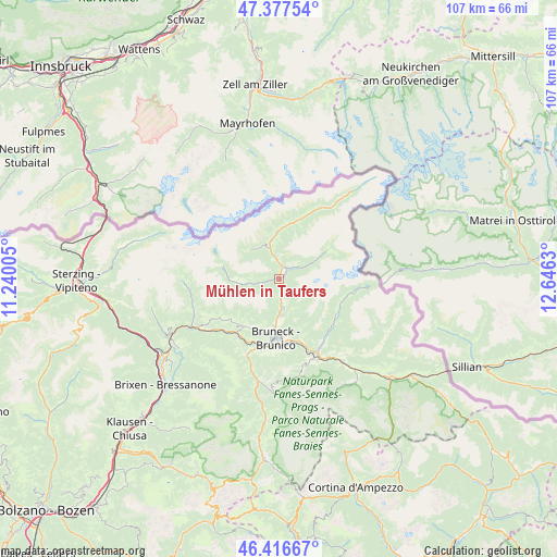
Mühlen in Taufers GPS coordinates[2]
46° 53' 57.336" North, 11° 56' 35.412" East
| Map corner | latitude | longitude |
|---|---|---|
| Upper-left | 47.37754°, | 11.24005° |
| Center: | 46.89926°, | 11.94317° |
| Lower-right: | 46.41667°, | 12.6463° |
| Map W x H: | 106.8×106.8 km | = 66.4×66.4mi |
| max Lat: | 47.04031° ⇑0.1% North |
| Mühlen in Taufers: | 46.89926° |
| min Lat: | ⇓99.9% South 35.50142° |
| min Long | Mühlen in Tauf | max Long |
| 6.69888° | 11.94317° | 18.48682° |
| W 55.1%⇐ | ⇒44.9% E |
Elevation
Elevation of Mühlen in Taufers is 859 m = 2818 ft, and this is 552.3 m = 1812 ft above average elevation for this country.
| Max E: |
2085 m = 6841 ft | 5.4% |
| Mühlen in Taufers | 859 m 2818 ft | |
| Avg. | 306.7 m = 1006 ft | |
Min E: |
-4 m = -13 ft | 94.6% |
See also: Italy elevation on elevation.city.
Geographical zone
Mühlen in Taufers is located in North temperate zone (between Tropic of Cancer and the Arctic Circle). Distance of this North polar circle is 2186.5 km =1358.6 mi to North.| Distance of | km | miles | from Mühlen in Taufers |
|---|---|---|---|
| North Pole | 4792.4 | 2977.9 | to North |
| Arctic Circle | 2186.5 | 1358.6 | to North |
| Tropic Cancer | 2608.8 | 1621 | to South |
| Equator | 5214.7 | 3240.3 | to South |


Nearby cities:
15 places around Mühlen in Taufers: (largest is in red/bold)
• Anterselva di Mezzo
12.7 km =7.9 mi,  110°
110°
• Brunico
11.1 km =6.9 mi,  183°
183°
• Cadipietra
11.1 km =6.9 mi,  14°
14°
• Campo Tures
1.7 km =1.1 mi,  51°
51°
• Chienes
12.9 km =8 mi,  217°
217°
• Falzes
10.6 km =6.6 mi,  205°
205°
• Gais
7 km =4.3 mi, 176°
• Lutago
5.9 km =3.7 mi,  340°
340°
• Perca
12.2 km =7.6 mi,  165°
165°
• San Giovanni
9 km =5.6 mi,  359°
359°
• San Lorenzo di Sebato
13 km =8.1 mi,  191°
191°
• Selva dei Molini
6.5 km =4 mi,  261°
261°
• Teodone
10.7 km =6.6 mi, 176°
• Uttenheim
3.8 km =2.4 mi, 175°
• Valle Aurina - Ahrntal
11.1 km =6.9 mi, 14°
Sources, notices
• [Note1] Compared only with cities in Italy existing in our database
• [Src1] Map data: © OpenStreetMap contributors (CC-BY-SA)
• [Src2] Other city data from geonames.org with taken over terms of usage.
• [Src3] Geographical zone / Annual Mean Temperature by Robert A. Rohde @ Wikipedia
