Formazza geodata
Formazza (Piedmont) is a seat of a third-order administrative division; located in Italy in Europe/Rome (GMT+2) time zone. With population of 448 people, there are 10103 cities with bigger population in this country. Compared to other cities in Italy, 97.5% of cities are located further ↓South; 88.8% of cities are located further →East and 99.1% of cities have lower elevation than Formazza. Note1
Administrative division(s):
- Level 1: Piedmont
- Level 2: Provincia Verbano-Cusio-Ossola
- Level 3: Formazza


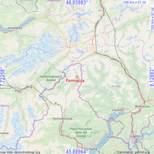
Formazza GPS coordinates[2]
46° 22' 36.804" North, 8° 25' 32.556" East
| Map corner | latitude | longitude |
|---|---|---|
| Upper-left | 46.85983°, | 7.72258° |
| Center: | 46.37689°, | 8.42571° |
| Lower-right: | 45.88964°, | 9.12883° |
| Map W x H: | 107.9×107.9 km | = 67×67mi |
| max Lat: | 47.04031° ⇑2.5% North |
| Formazza: | 46.37689° |
| min Lat: | ⇓97.5% South 35.50142° |
| min Long | Formazza | max Long |
| 6.69888° | 8.42571° | 18.48682° |
| W 11.2%⇐ | ⇒88.8% E |
Elevation
Elevation of Formazza is 1288 m = 4226 ft, and this is 981.3 m = 3219 ft above average elevation for this country.
| Max E: |
2085 m = 6841 ft | 0.90000000000001% |
| Formazza | 1288 m 4226 ft | |
| Avg. | 306.7 m = 1006 ft | |
Min E: |
-4 m = -13 ft | 99.1% |
See also: Italy elevation on elevation.city.
Geographical zone
Formazza is located in North temperate zone (between Tropic of Cancer and the Arctic Circle). Distance of this North polar circle is 2244.5 km =1394.7 mi to North.| Distance of | km | miles | from Formazza |
|---|---|---|---|
| North Pole | 4850.4 | 3013.9 | to North |
| Arctic Circle | 2244.5 | 1394.7 | to North |
| Tropic Cancer | 2550.7 | 1584.9 | to South |
| Equator | 5156.6 | 3204.2 | to South |


Nearby cities:
15 places around Formazza: (largest is in red/bold)
• Baceno
15.3 km =9.5 mi,  212°
212°
• Craveggia
26.7 km =16.6 mi,  169°
169°
• Crevoladossola
27.2 km =16.9 mi,  201°
201°
• Crodo
19.4 km =12.1 mi, 204°
• Druogno
27 km =16.8 mi,  178°
178°
• Malesco
28.2 km =17.5 mi, 168°
• Masera
27.6 km =17.1 mi, 196°
• Montecrestese
24.8 km =15.4 mi, 197°
• Pontetto-Roldo
26.3 km =16.3 mi, 197°
• Premia
13.8 km =8.6 mi, 209°
• Santa Maria Maggiore
26.8 km =16.7 mi, 174°
• Toceno
26 km =16.2 mi, 172°
• Trasquera
24.5 km =15.2 mi,  221°
221°
• Varzo
23.1 km =14.4 mi, 215°
• Villette
28.5 km =17.7 mi,  162°
162°
Sources, notices
• [Note1] Compared only with cities in Italy existing in our database
• [Src1] Map data: © OpenStreetMap contributors (CC-BY-SA)
• [Src2] Other city data from geonames.org with taken over terms of usage.
• [Src3] Geographical zone / Annual Mean Temperature by Robert A. Rohde @ Wikipedia
