Fonteblanda geodata
Fonteblanda (Tuscany) is a populated place; located in Italy in Europe/Rome (GMT+2) time zone. With population of 1,088 people, there are 6337 cities with bigger population in this country. Compared to other cities in Italy, 65.9% of cities are located further ↑North; 54.8% of cities are located further →East and 84.4% of cities have higher elevation than Fonteblanda. Note1


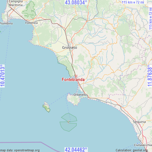
Fonteblanda GPS coordinates[2]
42° 33' 52.668" North, 11° 10' 23.7" East
| Map corner | latitude | longitude |
|---|---|---|
| Upper-left | 43.08034°, | 10.47013° |
| Center: | 42.56463°, | 11.17325° |
| Lower-right: | 42.04462°, | 11.87638° |
| Map W x H: | 115.2×115.2 km | = 71.6×71.6mi |
| max Lat: | 47.04031° ⇑65.9% North |
| Fonteblanda: | 42.56463° |
| min Lat: | ⇓34.1% South 35.50142° |
| min Long | Fonteblanda | max Long |
| 6.69888° | 11.17325° | 18.48682° |
| W 45.2%⇐ | ⇒54.8% E |
Elevation
Elevation of Fonteblanda is 33 m = 108 ft, and this is 273.7 m = 898 ft below average elevation for this country.
| Max E: |
2085 m = 6841 ft | 84.4% |
| Avg. | 306.7 m = 1006 ft | |
| Fonteblanda | 33 m = 108 ft | |
Min E: |
-4 m = -13 ft | 15.6% |
See also: Italy elevation on elevation.city.
Geographical zone
Fonteblanda is located in North temperate zone (between Tropic of Cancer and the Arctic Circle). Distance of this Northern Tropic circle is 2126.8 km =1321.5 mi to South.| Distance of | km | miles | from Fonteblanda |
|---|---|---|---|
| North Pole | 5274.3 | 3277.3 | to North |
| Arctic Circle | 2668.4 | 1658.1 | to North |
| Tropic Cancer | 2126.8 | 1321.5 | to South |
| Equator | 4732.7 | 2940.8 | to South |


Nearby cities:
15 places around Fonteblanda: (largest is in red/bold)
• Albinia
7.5 km =4.7 mi,  156°
156°
• Capalbio
23.8 km =14.8 mi,  121°
121°
• Capalbio Scalo
23.7 km =14.7 mi,  136°
136°
• Grosseto
22.7 km =14.1 mi,  346°
346°
• Istia D'Ombrone-Le Stiacciole
24.2 km =15 mi,  2°
2°
• Magliano in Toscana
10.4 km =6.5 mi,  69°
69°
• Marina di Grosseto
23.3 km =14.5 mi,  317°
317°
• Monte Argentario
15.1 km =9.4 mi,  196°
196°
• Montiano
9.8 km =6.1 mi,  24°
24°
• Orbetello
14.2 km =8.8 mi, 163°
• Orbetello Scalo
14.3 km =8.9 mi,  154°
154°
• Porto Ercole
18.3 km =11.4 mi,  171°
171°
• Porto Santo Stefano
14.8 km =9.2 mi, 198°
• Rispescia
16.1 km =10 mi, 349°
• Scansano
18.7 km =11.6 mi,  43°
43°
Sources, notices
• [Note1] Compared only with cities in Italy existing in our database
• [Src1] Map data: © OpenStreetMap contributors (CC-BY-SA)
• [Src2] Other city data from geonames.org with taken over terms of usage.
• [Src3] Geographical zone / Annual Mean Temperature by Robert A. Rohde @ Wikipedia
