Fermignano geodata
Fermignano (The Marches) is a seat of a third-order administrative division; located in Italy in Europe/Rome (GMT+2) time zone. With population of 7,309 people, there are 1332 cities with bigger population in this country. Compared to other cities in Italy, 58.2% of cities are located further ↑North; 64.4% of cities are located further ←West and 57% of cities have higher elevation than Fermignano. Note1
Administrative division(s):
- Level 1: The Marches
- Level 2: Provincia di Pesaro e Urbino
- Level 3: Fermignano


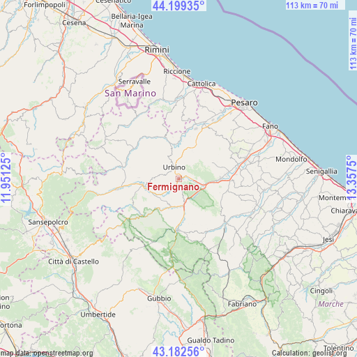
Fermignano GPS coordinates[2]
43° 41' 35.196" North, 12° 39' 15.732" East
| Map corner | latitude | longitude |
|---|---|---|
| Upper-left | 44.19935°, | 11.95125° |
| Center: | 43.69311°, | 12.65437° |
| Lower-right: | 43.18256°, | 13.3575° |
| Map W x H: | 113.1×113.1 km | = 70.3×70.3mi |
| max Lat: | 47.04031° ⇑58.2% North |
| Fermignano: | 43.69311° |
| min Lat: | ⇓41.8% South 35.50142° |
| min Long | Fermignano | max Long |
| 6.69888° | 12.65437° | 18.48682° |
| W 64.4%⇐ | ⇒35.6% E |
Elevation
Elevation of Fermignano is 188 m = 617 ft, and this is 118.7 m = 389 ft below average elevation for this country.
| Max E: |
2085 m = 6841 ft | 57% |
| Avg. | 306.7 m = 1006 ft | |
| Fermignano | 188 m = 617 ft | |
Min E: |
-4 m = -13 ft | 43% |
See also: Italy elevation on elevation.city.
Geographical zone
Fermignano is located in North temperate zone (between Tropic of Cancer and the Arctic Circle). Distance of this Northern Tropic circle is 2252.3 km =1399.5 mi to South.| Distance of | km | miles | from Fermignano |
|---|---|---|---|
| North Pole | 5148.8 | 3199.3 | to North |
| Arctic Circle | 2543 | 1580.1 | to North |
| Tropic Cancer | 2252.3 | 1399.5 | to South |
| Equator | 4858.2 | 3018.7 | to South |


Nearby cities:
15 places around Fermignano: (largest is in red/bold)
• Acqualagna
7.7 km =4.8 mi,  166°
166°
• Bellaria-Pole-Petriccio
9 km =5.6 mi,  191°
191°
• Ca' Gallo
12.2 km =7.6 mi,  347°
347°
• Canavaccio
3.6 km =2.2 mi,  88°
88°
• Fossombrone
12.7 km =7.9 mi, 91°
• Gadana
6.7 km =4.2 mi,  337°
337°
• Gallo
11.4 km =7.1 mi,  24°
24°
• Isola del Piano
11.5 km =7.1 mi,  64°
64°
• Montecalvo in Foglia
13.2 km =8.2 mi, 352°
• Peglio
12.6 km =7.8 mi,  271°
271°
• Petriano
11.4 km =7.1 mi,  33°
33°
• Ponte Armellina Zona Residenziale
10.8 km =6.7 mi, 25°
• Trasanni
6.8 km =4.2 mi,  6°
6°
• Urbania
11.1 km =6.9 mi,  255°
255°
• Urbino
4 km =2.5 mi, 338°
Sources, notices
• [Note1] Compared only with cities in Italy existing in our database
• [Src1] Map data: © OpenStreetMap contributors (CC-BY-SA)
• [Src2] Other city data from geonames.org with taken over terms of usage.
• [Src3] Geographical zone / Annual Mean Temperature by Robert A. Rohde @ Wikipedia
