Urbania geodata
Urbania (The Marches) is a seat of a third-order administrative division; located in Italy in Europe/Rome (GMT+2) time zone. With population of 5,499 people, there are 1784 cities with bigger population in this country. Compared to other cities in Italy, 58.5% of cities are located further ↑North; 62.6% of cities are located further ←West and 57.2% of cities have lower elevation than Urbania. Note1
Administrative division(s):
- Level 1: The Marches
- Level 2: Provincia di Pesaro e Urbino
- Level 3: Urbania


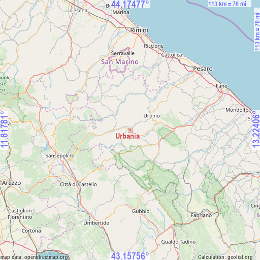
Urbania GPS coordinates[2]
43° 40' 5.952" North, 12° 31' 15.348" East
| Map corner | latitude | longitude |
|---|---|---|
| Upper-left | 44.17477°, | 11.81781° |
| Center: | 43.66832°, | 12.52093° |
| Lower-right: | 43.15756°, | 13.22406° |
| Map W x H: | 113.1×113.1 km | = 70.3×70.3mi |
| max Lat: | 47.04031° ⇑58.5% North |
| Urbania: | 43.66832° |
| min Lat: | ⇓41.5% South 35.50142° |
| min Long | Urbania | max Long |
| 6.69888° | 12.52093° | 18.48682° |
| W 62.6%⇐ | ⇒37.4% E |
Elevation
Elevation of Urbania is 280 m = 919 ft, and this is 26.7 m = 88 ft below average elevation for this country.
| Max E: |
2085 m = 6841 ft | 42.8% |
| Avg. | 306.7 m = 1006 ft | |
| Urbania | 280 m = 919 ft | |
Min E: |
-4 m = -13 ft | 57.2% |
See also: Italy elevation on elevation.city.
Geographical zone
Urbania is located in North temperate zone (between Tropic of Cancer and the Arctic Circle). Distance of this Northern Tropic circle is 2249.5 km =1397.8 mi to South.| Distance of | km | miles | from Urbania |
|---|---|---|---|
| North Pole | 5151.6 | 3201.1 | to North |
| Arctic Circle | 2545.7 | 1581.8 | to North |
| Tropic Cancer | 2249.5 | 1397.8 | to South |
| Equator | 4855.5 | 3017.1 | to South |


Nearby cities:
15 places around Urbania: (largest is in red/bold)
• Acqualagna
13.3 km =8.3 mi,  110°
110°
• Apecchio
14.5 km =9 mi,  213°
213°
• Belforte
12.9 km =8 mi,  294°
294°
• Bellaria-Pole-Petriccio
10.8 km =6.7 mi,  124°
124°
• Canavaccio
14.6 km =9.1 mi,  78°
78°
• Fermignano
11.1 km =6.9 mi, 75°
• Gadana
12.1 km =7.5 mi,  42°
42°
• Lunano
9.5 km =5.9 mi,  318°
318°
• Mercatale
13.1 km =8.1 mi,  347°
347°
• Peglio
3.6 km =2.2 mi,  329°
329°
• Piandimeleto
10.9 km =6.8 mi,  304°
304°
• Piobbico
9 km =5.6 mi,  185°
185°
• Sant'Angelo in Vado
8.3 km =5.2 mi,  267°
267°
• Sassocorvaro
12.8 km =8 mi, 352°
• Urbino
11.3 km =7 mi,  55°
55°
Sources, notices
• [Note1] Compared only with cities in Italy existing in our database
• [Src1] Map data: © OpenStreetMap contributors (CC-BY-SA)
• [Src2] Other city data from geonames.org with taken over terms of usage.
• [Src3] Geographical zone / Annual Mean Temperature by Robert A. Rohde @ Wikipedia
