Dumenza geodata
Dumenza (Lombardy) is a seat of a third-order administrative division; located in Italy in Europe/Rome (GMT+2) time zone. With population of 882 people, there are 7255 cities with bigger population in this country. Compared to other cities in Italy, 92.4% of cities are located further ↓South; 84.3% of cities are located further →East and 72.5% of cities have lower elevation than Dumenza. Note1


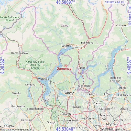
Dumenza GPS coordinates[2]
46° 1' 15.168" North, 8° 47' 12.264" East
| Map corner | latitude | longitude |
|---|---|---|
| Upper-left | 46.50697°, | 8.08362° |
| Center: | 46.02088°, | 8.78674° |
| Lower-right: | 45.53048°, | 9.48987° |
| Map W x H: | 108.6×108.6 km | = 67.5×67.5mi |
| max Lat: | 47.04031° ⇑7.6% North |
| Dumenza: | 46.02088° |
| min Lat: | ⇓92.4% South 35.50142° |
| min Long | Dumenza | max Long |
| 6.69888° | 8.78674° | 18.48682° |
| W 15.7%⇐ | ⇒84.3% E |
Elevation
Elevation of Dumenza is 420 m = 1378 ft, and this is 113.3 m = 372 ft above average elevation for this country.
| Max E: |
2085 m = 6841 ft | 27.5% |
| Dumenza | 420 m 1378 ft | |
| Avg. | 306.7 m = 1006 ft | |
Min E: |
-4 m = -13 ft | 72.5% |
See also: Italy elevation on elevation.city.
Geographical zone
Dumenza is located in North temperate zone (between Tropic of Cancer and the Arctic Circle). Distance of this North polar circle is 2284.1 km =1419.3 mi to North.| Distance of | km | miles | from Dumenza |
|---|---|---|---|
| North Pole | 4890 | 3038.5 | to North |
| Arctic Circle | 2284.1 | 1419.3 | to North |
| Tropic Cancer | 2511.1 | 1560.3 | to South |
| Equator | 5117 | 3179.6 | to South |


Nearby cities:
15 places around Dumenza: (largest is in red/bold)
• Agra
2.3 km =1.4 mi,  321°
321°
• Bedero
7.1 km =4.4 mi,  227°
227°
• Brezzo di Bedero
7.1 km =4.4 mi, 228°
• Colmegna
2.5 km =1.6 mi,  286°
286°
• Cremenaga
3.7 km =2.3 mi,  159°
159°
• Curiglia
4.6 km =2.9 mi,  17°
17°
• Germignaga
5.9 km =3.7 mi,  235°
235°
• Grantola
8 km =5 mi,  186°
186°
• Luino
3.8 km =2.4 mi, 236°
• Maccagno
4.8 km =3 mi,  301°
301°
• Mesenzana
7.9 km =4.9 mi, 192°
• Montegrino Valtravaglia
5.4 km =3.4 mi,  195°
195°
• Piano
6.8 km =4.2 mi, 202°
• Poppino
1.8 km =1.1 mi,  247°
247°
• Veddasca
5.6 km =3.5 mi,  9°
9°
Sources, notices
• [Note1] Compared only with cities in Italy existing in our database
• [Src1] Map data: © OpenStreetMap contributors (CC-BY-SA)
• [Src2] Other city data from geonames.org with taken over terms of usage.
• [Src3] Geographical zone / Annual Mean Temperature by Robert A. Rohde @ Wikipedia
