Curiglia geodata
Curiglia (Lombardy) is a seat of a third-order administrative division; located in Italy in Europe/Rome (GMT+2) time zone. With population of 160 people, there are 11249 cities with bigger population in this country. Compared to other cities in Italy, 93.2% of cities are located further ↓South; 84.1% of cities are located further →East and 88.7% of cities have lower elevation than Curiglia. Note1
Administrative division(s):
- Level 1: Lombardy
- Level 2: Provincia di Varese
- Level 3: Curiglia con Monteviasco


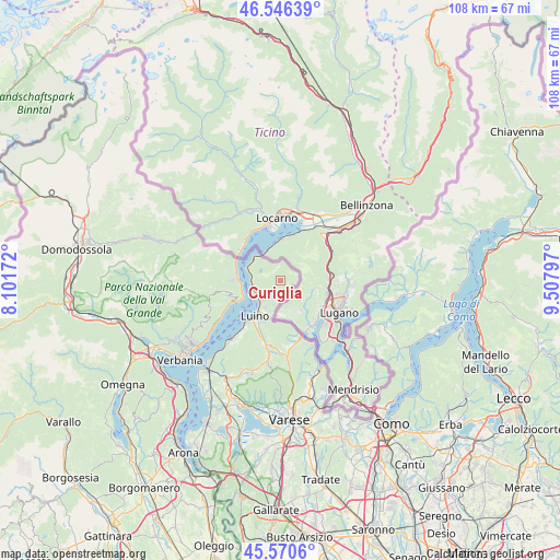
Curiglia GPS coordinates[2]
46° 3' 38.34" North, 8° 48' 17.424" East
| Map corner | latitude | longitude |
|---|---|---|
| Upper-left | 46.54639°, | 8.10172° |
| Center: | 46.06065°, | 8.80484° |
| Lower-right: | 45.5706°, | 9.50797° |
| Map W x H: | 108.5×108.5 km | = 67.4×67.4mi |
| max Lat: | 47.04031° ⇑6.8% North |
| Curiglia: | 46.06065° |
| min Lat: | ⇓93.2% South 35.50142° |
| min Long | Curiglia | max Long |
| 6.69888° | 8.80484° | 18.48682° |
| W 15.9%⇐ | ⇒84.1% E |
Elevation
Elevation of Curiglia is 686 m = 2251 ft, and this is 379.3 m = 1244 ft above average elevation for this country.
| Max E: |
2085 m = 6841 ft | 11.3% |
| Curiglia | 686 m 2251 ft | |
| Avg. | 306.7 m = 1006 ft | |
Min E: |
-4 m = -13 ft | 88.7% |
See also: Italy elevation on elevation.city.
Geographical zone
Curiglia is located in North temperate zone (between Tropic of Cancer and the Arctic Circle). Distance of this North polar circle is 2279.7 km =1416.5 mi to North.| Distance of | km | miles | from Curiglia |
|---|---|---|---|
| North Pole | 4885.6 | 3035.8 | to North |
| Arctic Circle | 2279.7 | 1416.5 | to North |
| Tropic Cancer | 2515.5 | 1563.1 | to South |
| Equator | 5121.5 | 3182.4 | to South |


Nearby cities:
15 places around Curiglia: (largest is in red/bold)
• Agra
3.9 km =2.4 mi,  226°
226°
• Cannero Riviera
10.6 km =6.6 mi,  246°
246°
• Cannobio
8.4 km =5.2 mi,  271°
271°
• Colmegna
5.3 km =3.3 mi, 225°
• Cremenaga
7.9 km =4.9 mi,  180°
180°
• Dumenza
4.6 km =2.9 mi,  197°
197°
• Germignaga
9.9 km =6.2 mi,  218°
218°
• Luino
8 km =5 mi, 215°
• Maccagno
5.8 km =3.6 mi, 250°
• Montegrino Valtravaglia
10.1 km =6.3 mi, 196°
• Pino sulla Sponda del Lago Maggiore
6.8 km =4.2 mi,  311°
311°
• Poppino
6 km =3.7 mi,  211°
211°
• Trarego
10.8 km =6.7 mi, 254°
• Tronzano Lago Maggiore
6.4 km =4 mi,  299°
299°
• Veddasca
1.2 km =0.7 mi,  336°
336°
Sources, notices
• [Note1] Compared only with cities in Italy existing in our database
• [Src1] Map data: © OpenStreetMap contributors (CC-BY-SA)
• [Src2] Other city data from geonames.org with taken over terms of usage.
• [Src3] Geographical zone / Annual Mean Temperature by Robert A. Rohde @ Wikipedia
