Dosso geodata
Dosso (Emilia-Romagna) is a populated place; located in Italy in Europe/Rome (GMT+2) time zone. With population of 1,436 people, there are 5274 cities with bigger population in this country. Compared to other cities in Italy, 55.6% of cities are located further ↓South; 52.6% of cities are located further →East and 92.1% of cities have higher elevation than Dosso. Note1
Administrative division(s):
- Level 1: Emilia-Romagna
- Level 2: Provincia di Ferrara
- Level 3: Terre del Reno


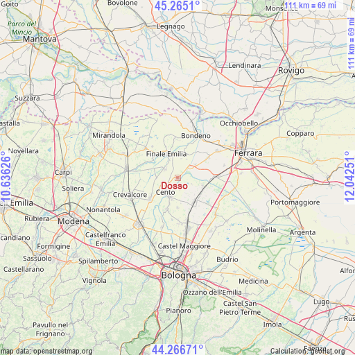
Dosso GPS coordinates[2]
44° 46' 5.016" North, 11° 20' 21.768" East
| Map corner | latitude | longitude |
|---|---|---|
| Upper-left | 45.2651°, | 10.63626° |
| Center: | 44.76806°, | 11.33938° |
| Lower-right: | 44.26671°, | 12.04251° |
| Map W x H: | 111×111 km | = 69×69mi |
| max Lat: | 47.04031° ⇑44.4% North |
| Dosso: | 44.76806° |
| min Lat: | ⇓55.6% South 35.50142° |
| min Long | Dosso | max Long |
| 6.69888° | 11.33938° | 18.48682° |
| W 47.4%⇐ | ⇒52.6% E |
Elevation
Elevation of Dosso is 14 m = 46 ft, and this is 292.7 m = 960 ft below average elevation for this country.
| Max E: |
2085 m = 6841 ft | 92.1% |
| Avg. | 306.7 m = 1006 ft | |
| Dosso | 14 m = 46 ft | |
Min E: |
-4 m = -13 ft | 7.9% |
See also: Italy elevation on elevation.city.
Geographical zone
Dosso is located in North temperate zone (between Tropic of Cancer and the Arctic Circle). Distance of this Northern Tropic circle is 2371.8 km =1473.8 mi to South.| Distance of | km | miles | from Dosso |
|---|---|---|---|
| North Pole | 5029.3 | 3125.1 | to North |
| Arctic Circle | 2423.4 | 1505.8 | to North |
| Tropic Cancer | 2371.8 | 1473.8 | to South |
| Equator | 4977.7 | 3093 | to South |


Nearby cities:
15 places around Dosso: (largest is in red/bold)
• Cento
5.8 km =3.6 mi,  225°
225°
• Corpo Reno
2.8 km =1.7 mi,  241°
241°
• Dodici Morelli
4.7 km =2.9 mi,  305°
305°
• Finale Emilia
8.1 km =5 mi,  333°
333°
• Galliera
4.7 km =2.9 mi,  115°
115°
• Maccaretolo
9.1 km =5.7 mi,  127°
127°
• Palata Pepoli
8.8 km =5.5 mi,  287°
287°
• Pieve di Cento
6.6 km =4.1 mi,  201°
201°
• Renazzo
4.2 km =2.6 mi,  265°
265°
• Reno Centese
6.8 km =4.2 mi,  353°
353°
• San Carlo
6.8 km =4.2 mi,  54°
54°
• San Pietro in Casale
9.1 km =5.7 mi,  145°
145°
• San Venanzio
8.1 km =5 mi,  108°
108°
• San Vincenzo
8.3 km =5.2 mi, 112°
• Sant'Agostino
4.5 km =2.8 mi, 53°
Sources, notices
• [Note1] Compared only with cities in Italy existing in our database
• [Src1] Map data: © OpenStreetMap contributors (CC-BY-SA)
• [Src2] Other city data from geonames.org with taken over terms of usage.
• [Src3] Geographical zone / Annual Mean Temperature by Robert A. Rohde @ Wikipedia
