Cumiana geodata
Cumiana (Piedmont) is a seat of a third-order administrative division; located in Italy in Europe/Rome (GMT+2) time zone. With population of 5,498 people, there are 1786 cities with bigger population in this country. Compared to other cities in Italy, 59.4% of cities are located further ↓South; 98.5% of cities are located further →East and 65.8% of cities have lower elevation than Cumiana. Note1


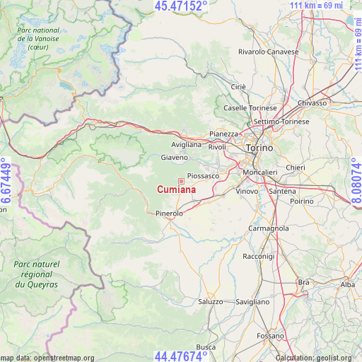
Cumiana GPS coordinates[2]
44° 58' 34.644" North, 7° 22' 39.396" East
| Map corner | latitude | longitude |
|---|---|---|
| Upper-left | 45.47152°, | 6.67449° |
| Center: | 44.97629°, | 7.37761° |
| Lower-right: | 44.47674°, | 8.08074° |
| Map W x H: | 110.6×110.6 km | = 68.7×68.7mi |
| max Lat: | 47.04031° ⇑40.6% North |
| Cumiana: | 44.97629° |
| min Lat: | ⇓59.4% South 35.50142° |
| min Long | Cumiana | max Long |
| 6.69888° | 7.37761° | 18.48682° |
| W 1.5%⇐ | ⇒98.5% E |
Elevation
Elevation of Cumiana is 351 m = 1152 ft, and this is 44.3 m = 145 ft above average elevation for this country.
| Max E: |
2085 m = 6841 ft | 34.2% |
| Cumiana | 351 m 1152 ft | |
| Avg. | 306.7 m = 1006 ft | |
Min E: |
-4 m = -13 ft | 65.8% |
See also: Italy elevation on elevation.city.
Geographical zone
Cumiana is located in North temperate zone (between Tropic of Cancer and the Arctic Circle). Distance of this Northern Tropic circle is 2395 km =1488.2 mi to South.| Distance of | km | miles | from Cumiana |
|---|---|---|---|
| North Pole | 5006.2 | 3110.7 | to North |
| Arctic Circle | 2400.3 | 1491.5 | to North |
| Tropic Cancer | 2395 | 1488.2 | to South |
| Equator | 5000.9 | 3107.4 | to South |


Nearby cities:
15 places around Cumiana: (largest is in red/bold)
• Bruino
9 km =5.6 mi,  61°
61°
• Cantalupa
5 km =3.1 mi,  227°
227°
• Frossasco
6.1 km =3.8 mi,  184°
184°
• Giaveno
7.9 km =4.9 mi,  342°
342°
• Piossasco
6.6 km =4.1 mi,  78°
78°
• Piscina
7.4 km =4.6 mi,  149°
149°
• Pontepietra
8.7 km =5.4 mi,  328°
328°
• Reano
9.3 km =5.8 mi,  25°
25°
• Riva
9.3 km =5.8 mi, 177°
• Roletto
6.8 km =4.2 mi,  211°
211°
• San Bernardino
6.8 km =4.2 mi,  12°
12°
• San Pietro Val Lemina
9.4 km =5.8 mi, 214°
• Sangano
7.9 km =4.9 mi,  46°
46°
• Trana
7.7 km =4.8 mi, 26°
• Viotto
9.5 km =5.9 mi, 149°
Sources, notices
• [Note1] Compared only with cities in Italy existing in our database
• [Src1] Map data: © OpenStreetMap contributors (CC-BY-SA)
• [Src2] Other city data from geonames.org with taken over terms of usage.
• [Src3] Geographical zone / Annual Mean Temperature by Robert A. Rohde @ Wikipedia
