Covo geodata
Covo (Lombardy) is a seat of a third-order administrative division; located in Italy in Europe/Rome (GMT+2) time zone. With population of 3,682 people, there are 2572 cities with bigger population in this country. Compared to other cities in Italy, 73.6% of cities are located further ↓South; 70% of cities are located further →East and 67.1% of cities have higher elevation than Covo. Note1


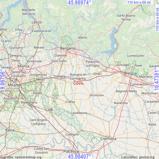
Covo GPS coordinates[2]
45° 29' 56.616" North, 9° 46' 14.448" East
| Map corner | latitude | longitude |
|---|---|---|
| Upper-left | 45.98974°, | 9.06756° |
| Center: | 45.49906°, | 9.77068° |
| Lower-right: | 45.00407°, | 10.47381° |
| Map W x H: | 109.6×109.6 km | = 68.1×68.1mi |
| max Lat: | 47.04031° ⇑26.4% North |
| Covo: | 45.49906° |
| min Lat: | ⇓73.6% South 35.50142° |
| min Long | Covo | max Long |
| 6.69888° | 9.77068° | 18.48682° |
| W 30%⇐ | ⇒70% E |
Elevation
Elevation of Covo is 115 m = 377 ft, and this is 191.7 m = 629 ft below average elevation for this country.
| Max E: |
2085 m = 6841 ft | 67.1% |
| Avg. | 306.7 m = 1006 ft | |
| Covo | 115 m = 377 ft | |
Min E: |
-4 m = -13 ft | 32.9% |
See also: Italy elevation on elevation.city.
Geographical zone
Covo is located in North temperate zone (between Tropic of Cancer and the Arctic Circle). Distance of this North polar circle is 2342.2 km =1455.4 mi to North.| Distance of | km | miles | from Covo |
|---|---|---|---|
| North Pole | 4948 | 3074.5 | to North |
| Arctic Circle | 2342.2 | 1455.4 | to North |
| Tropic Cancer | 2453.1 | 1524.3 | to South |
| Equator | 5059 | 3143.5 | to South |


Nearby cities:
15 places around Covo: (largest is in red/bold)
• Antegnate
2.1 km =1.3 mi,  130°
130°
• Barbata
2.7 km =1.7 mi,  168°
168°
• Bariano
5.4 km =3.4 mi,  286°
286°
• Calcio
6.2 km =3.9 mi,  80°
80°
• Camisano
6.3 km =3.9 mi,  198°
198°
• Castel Gabbiano
5.4 km =3.4 mi,  230°
230°
• Cortenuova
4.6 km =2.9 mi,  16°
16°
• Cortenuova di Sopra
5 km =3.1 mi,  9°
9°
• Fara Olivana
1.7 km =1.1 mi,  255°
255°
• Fontanella
4.2 km =2.6 mi,  143°
143°
• Fornovo San Giovanni
7.3 km =4.5 mi,  268°
268°
• Isso
2.6 km =1.6 mi, 200°
• Morengo
6.2 km =3.9 mi,  305°
305°
• Mozzanica
6.9 km =4.3 mi,  248°
248°
• Romano di Lombardia
2.7 km =1.7 mi,  332°
332°
Sources, notices
• [Note1] Compared only with cities in Italy existing in our database
• [Src1] Map data: © OpenStreetMap contributors (CC-BY-SA)
• [Src2] Other city data from geonames.org with taken over terms of usage.
• [Src3] Geographical zone / Annual Mean Temperature by Robert A. Rohde @ Wikipedia
